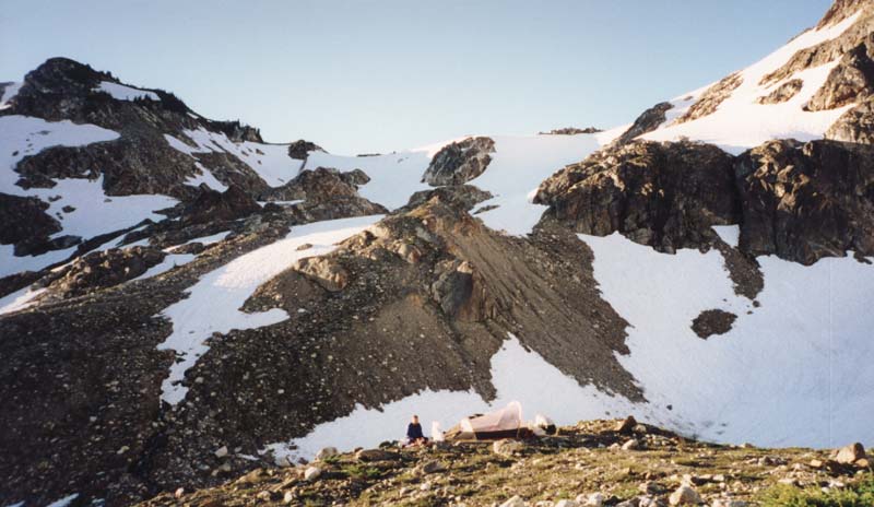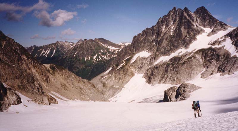
Breaking out of the trees
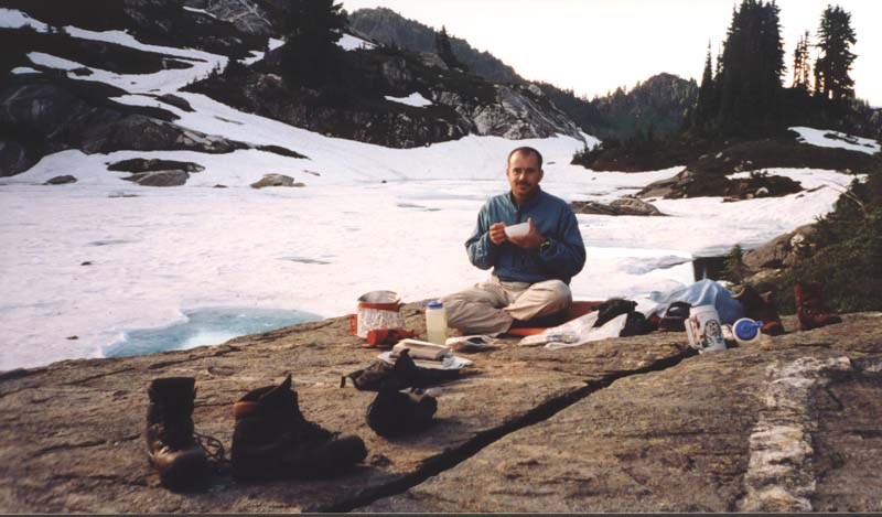
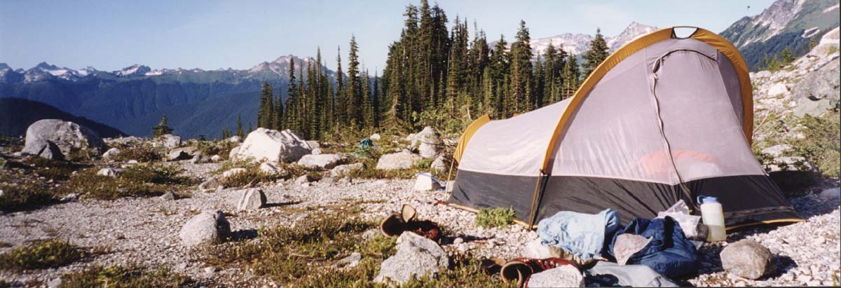
Kitchen on the rock
This is an eight day traverse from the Suiattle river trail to the White River trail, climbing Glacier Pk via the Chocolate Glacier.
[4,200 ft gain in 5 hours.]
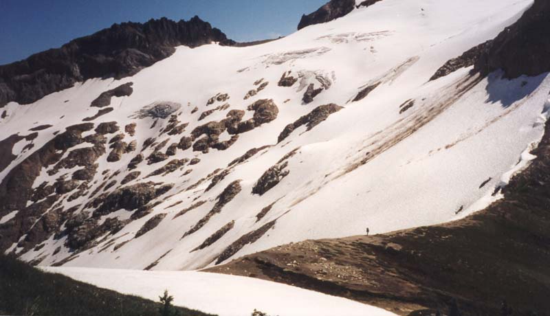
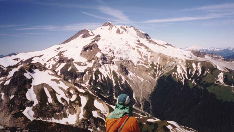
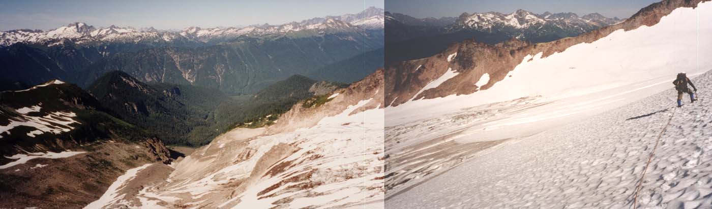
Andrew and I get dropped off at the Suiattle river trail head. We hike the Suiattle River trail and cross the bridge. At the first creek, which comes down from Rivord lake, we pick up a foot path just on the right (north) bank. The trail is faint at first, but becomes a clear path which goes up the broad ridge toward Box Mt. It is steep, brushy, and does not relent until 4000 ft. We are both glad for every piece of gear that we choose not to bring. At 4,500 ft we come out into some open country and the first decent camping options. We continued on and camped at the lake below Lime Mtn (5500 ft), where we camp on a snowfield and kitchen on top of a large bolder just at the lakes edge. After dinner I wrap myself in my sleeping bag and read 'till deep twilight.
|
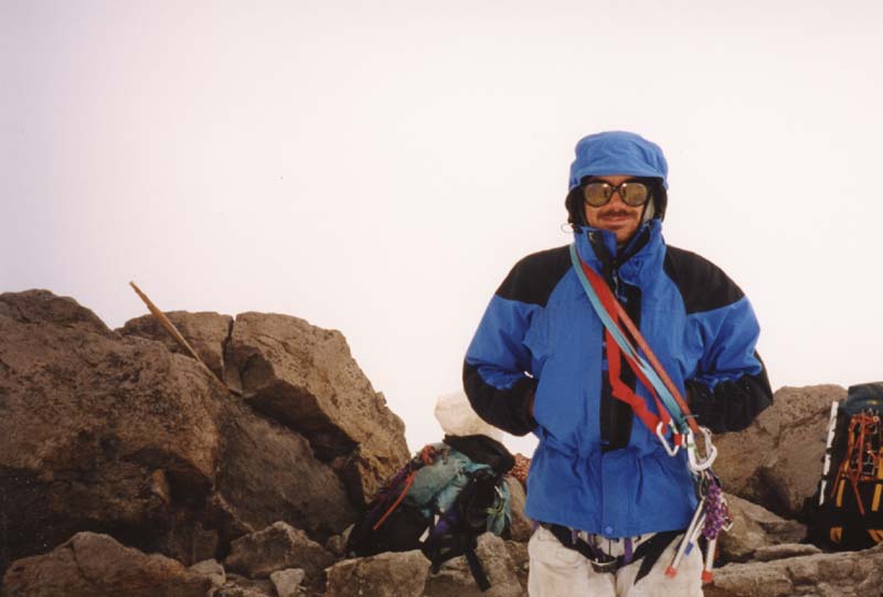
Breaking out of the trees |
Kitchen on the rock |
[2,800 gain, 2,600 ft loss, in 7:30 hours]
We hike south on Lime ridge, following the foot trail which passes to the east of most lakes. This is difficult walking on steep side hills with a lot of up and down over ridges. (At Lime Lake traverse high above (east) of lake, cross saddle, and walk along ENE facing slope to Mica Lake.) Getting over to Fire Creek Pass is a little difficult. We climb up to the ridge crest above Mica Lake and walk that down till we can step on the PCT. We camp in a basin just east of Fire Creek Pass. This took more energy than we expected to cover the distance that we did.
|
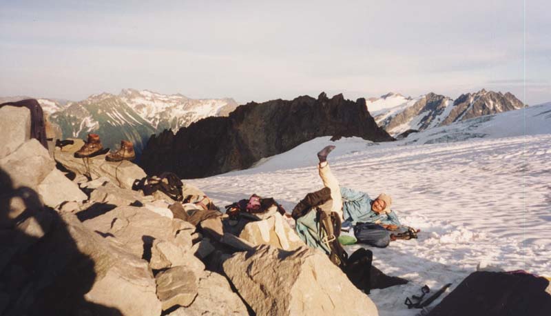
Looking south at our tent then the slope we climbed in the morning |
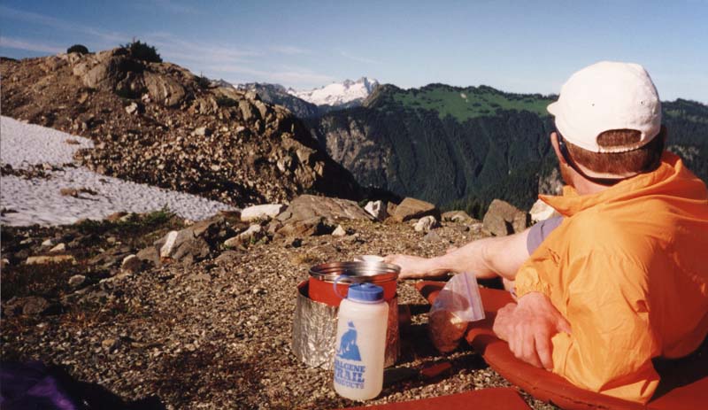
Andrew relaxing while we cook dinner in camp. |
[3,040 gain, 1,400 loss, 7 hours]
We have another leisurely morning cooking breakfast and enjoying our setting. Camp packed and walking by 9:30 or so.
|
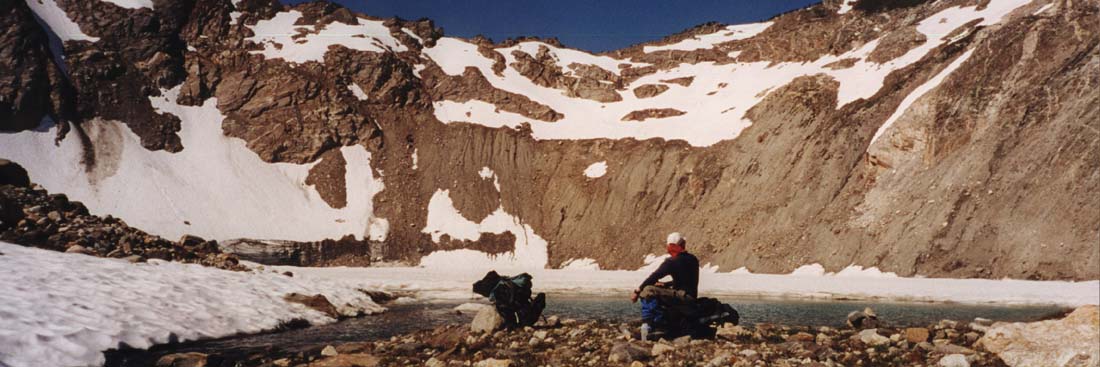
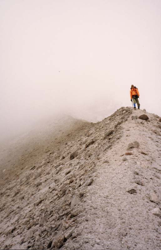
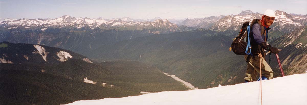
From our Fire Creek camp we climb directly south up a slope, cross a ridge, then descended a steep, loose slope to the SE, crossing the outlet of Milk Lake. The lake is marked as a glacier on the map but those days are gone, it's now a lake. The slope we came down is off to the right of the picture. The descent was difficult enough that next time I'll try walking the PCT to Pumice Creek then ascending to the ridge. |
Andrew at the outlet of Milk Lake. |
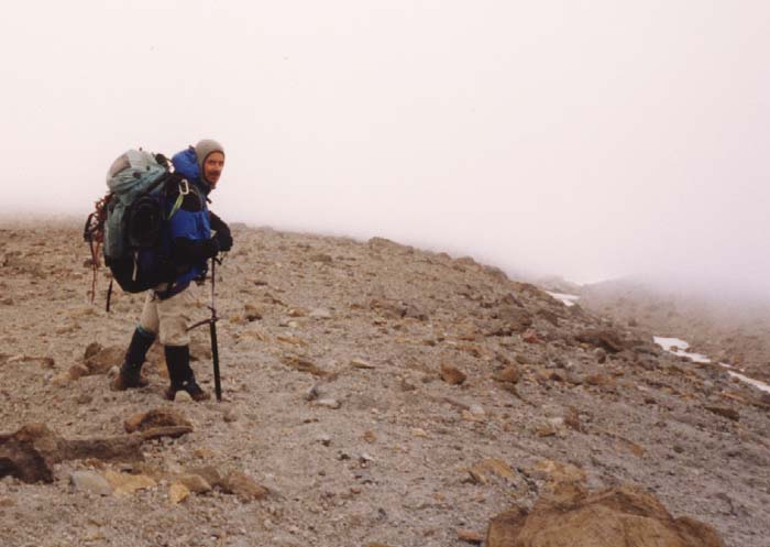
Continuing along the ridge, we work our way to the head of Pumice Creek were we break for a long lunch. This is a spectacular setting.
|
Me walking ridge. |
Me at the head of Pumice Crk. The Ptarmigan Glacier and the notch we crossed in the background. |
Ermine Glacier
|
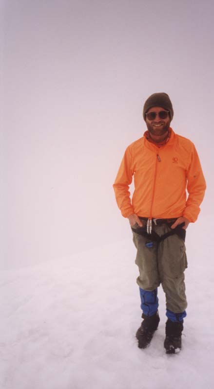
Me, stretching at our Dusty Glacier Camp |
It is another beautiful evening and we sit out on the glacier making dinner. We see some high clouds moving in which makes us doubt tomorrow's weather.
[3,400 gain, 3,800 loss, 11 hours]
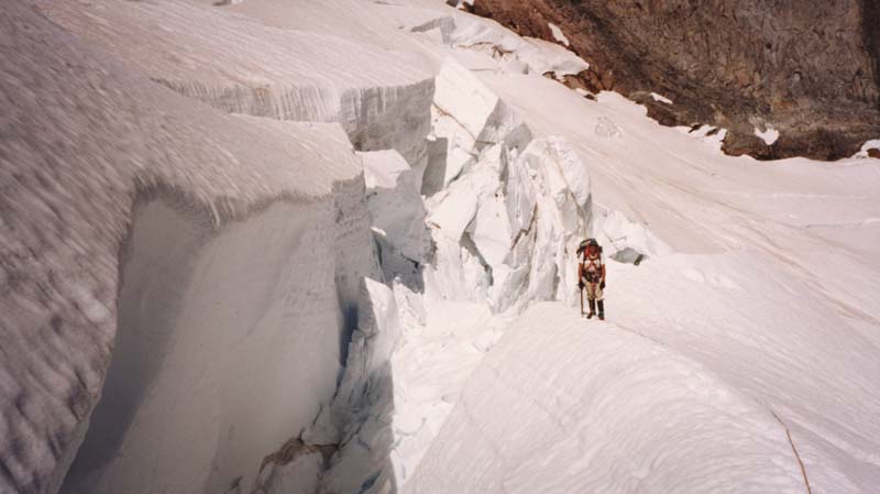
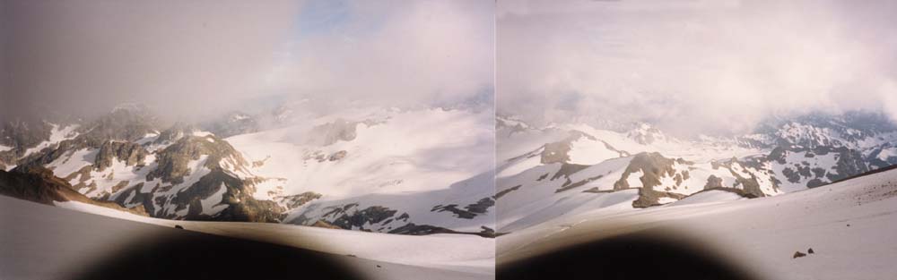
From camp we start out across the Dusty Glacier. We mess around in some crevasse fields for a little while then find a clear crossing of both the Dusty and North Guardian Glaciers at 7,500 ft and above. Views of the great chasm that the Dusty Creek has cut into the "Great Fill" are spectacular. The walls of the chasm are so steep and loose that the there is no way to cross Dusty Creek between our elevation and the Suiattle valley floor.
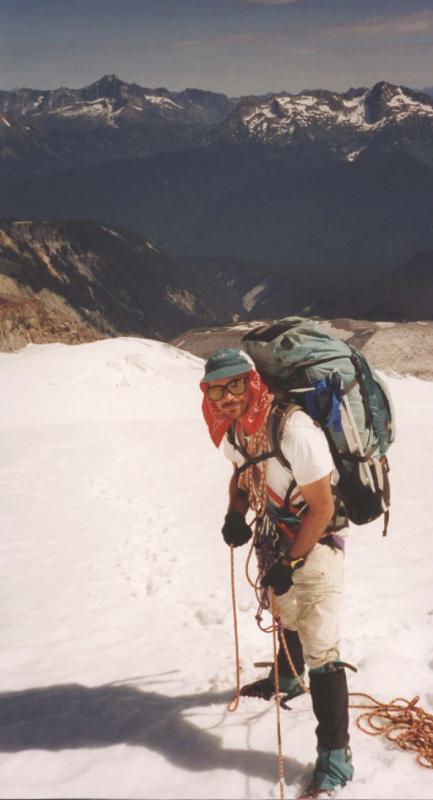
We step on to the Chocolate Glacier at the base of the rock ridge that separates it from the North Guardian, about 8,000 ft. The Chocolate is easiest to climb on the right (north) side, but half way up we wander into some crevasse fields in the middle and eventually have to back track a short distance. We lunch at 9,000 ft. before tackling the headwall.
|
Me at a crevasse in the Chocolate Glacier |
|
The top of the glacier is split by a cleaver. The right side is steeper, but we can see a continuos route up it. The left side is more moderate, but a portion is hidden and it could be impassible. We choose the devil we know, and ascend the left edge of the headwall, near the rock cleaver. It's about 45 degree snow with a few icy patches. We top out on the crater rim where we can look down on the other route and see it would have gone as well.
In the crater I take out my cell phone and call Marie. The call goes through and is very clear. We talk for a while about the trip and what she's doing. Then I ask her to check the weather report. She says it calls for a storm coming in this evening. That agrees with the thick clouds that have enveloped the summit. I really enjoyed using the phone to talk to Marie.
|
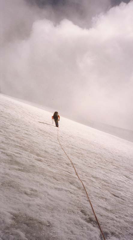
From the crater a steep icy slope leads to the summit. The very left verge is snowy and Andrew leads up that. There are a few steep sections, then the angle eases off to moderate ice which we diagonal up. Sometimes I look forward and Andrew is obscured by the clouds. At other times I can see past him to the summit. The clouds are whipping past and this is feeling like a very foreign place for us humans. |
 |
|
|
Our Summit Photos |
|
|
|
|
Descending the south ridge. |
We take a break and use the phone to call Lorna, Andrew's wife. We get her pager and enter the my phone's number. Then we wait. We are about to give up when the phone rings. I answer, it's for Andrew. They talk for a while and Andrew agrees that calling loved ones is fun.
It would be possible to cross Disappointment Peak and descend the south face, but that route has very loose rock. So, at the low point in the ridge we step onto the top of the Cool Glacier and descended the right (south) edge of that till we can cross the ridge at about 9,700. There is a small ice fall here, easily navigated. We traversed back to the long ridge running south from Disapointment Peak and descended on snow to its left (east). We are heading toward a rock island in the large basin east of Glacier gap.
 We find a reasonable site in the rock bands. While
Andrew makes us dinner, I set the tent with the foot toward the wind and under a small cliff for protection. As
the sun sets we crawl into the tent. It's a light weight Walrus Arch Rival. We brought it because it weighs only
4.25 lbs. But tonight it seems like poor shelter and the situation is not good. The wind is coming around the side
of the cliff and hitting the tent on my side, bowing the polls down into my face. The upper wall of the tent is
of netting and the fine dust carried by the wind filters through the net and settles down onto our faces. At 11
pm I get out and add improvised guy ropes to the edges of the fly. by 11:30 the wind has shaken them off and the
fly is flapping even harder than before. Tired of being in the tent I get up and walk around camp thinking about
the situation. I realized that this tent would actually be stronger if the wide, door end faced the wind. Also,
a near by flat spot seems to provide better shelter. Earlier I had rejected this site because it looked like it
flooded during rains, but now it seems more important to get out of the wind. Andrew obligingly gets out of the
tent and we carry the whole thing to the new site, steak it out, and get back in. Soon it starts to rain but, with
the door to the wind, the tent is much more secure and I soon fall asleep.
We find a reasonable site in the rock bands. While
Andrew makes us dinner, I set the tent with the foot toward the wind and under a small cliff for protection. As
the sun sets we crawl into the tent. It's a light weight Walrus Arch Rival. We brought it because it weighs only
4.25 lbs. But tonight it seems like poor shelter and the situation is not good. The wind is coming around the side
of the cliff and hitting the tent on my side, bowing the polls down into my face. The upper wall of the tent is
of netting and the fine dust carried by the wind filters through the net and settles down onto our faces. At 11
pm I get out and add improvised guy ropes to the edges of the fly. by 11:30 the wind has shaken them off and the
fly is flapping even harder than before. Tired of being in the tent I get up and walk around camp thinking about
the situation. I realized that this tent would actually be stronger if the wide, door end faced the wind. Also,
a near by flat spot seems to provide better shelter. Earlier I had rejected this site because it looked like it
flooded during rains, but now it seems more important to get out of the wind. Andrew obligingly gets out of the
tent and we carry the whole thing to the new site, steak it out, and get back in. Soon it starts to rain but, with
the door to the wind, the tent is much more secure and I soon fall asleep.
[370 gain, 1,720 loss, 3 hours]
I wake just before dawn and discover that the floor of the tent is very wet. I look out and find that our site is flooding. I tell Andrew. He curls into a ball. This could be the end of all creature comfort. Then we both get out into the elements again and dig a trench around the tent. When we see that the water is draining we get back into the tent and rest a while longer.
The rain has stoped, the flood waters subsided, and the incessant wind is actually drying off the tent. Things look OK for now, but neither of us want to spend another night like the last. We can make it down to treed shelter on the PCT by droping over Glacier Gap to Red Pass. But we would then be exchanging the spectacular DaKobed traverse for a mundane trail walk and likely coming out a couple days earlier. We try to call home to get a weather forecast but have no reception in this basin. So we spend the day reading, napping, and waiting. By mid afternoon we see significant breaks of blue sky and we decide to continue on the traverse.
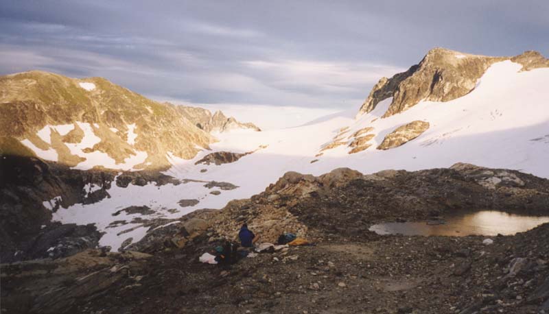
We circle the headwaters of the Suiattle, descending to the east side of the Honeycomb Glacier, exit the glacier, cross a small saddle, and drop down to a tarn at 5,600 ft, below the north face of Ten Peak Mtn. Just north of the tarn is some beautiful camping on flat gravel with spectacular views of the Suiattle River and the SE side of Glacier Pk. Just beyond that is a tree covered ridge (which I scout for sheltered camp sites in case we have more weather).
|
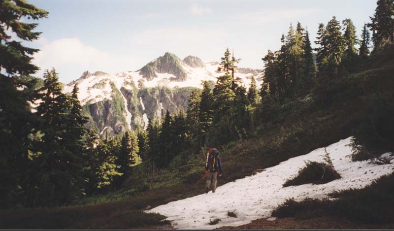
Descending the Honeycomb with Ten Peak on the right. |
Our camp below Ten Peak |
For the first time, the mosquitos are bad. We hide in the tent awhile and eat at dusk.
[2,530 gain, 2,530 loss, 8 hours]
|
The north face of Ten Peak. |
|
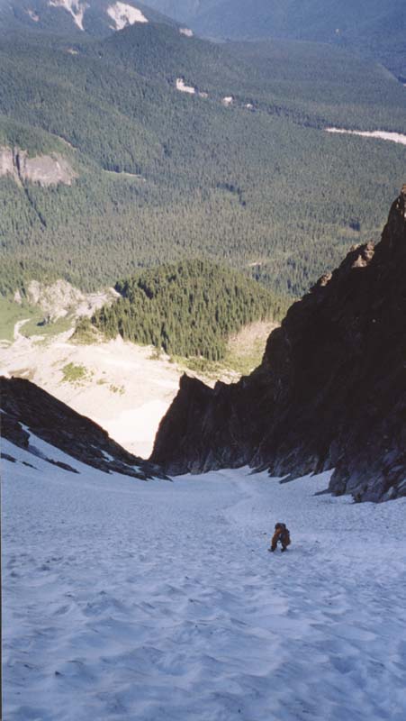
Me climbing the gully. |
We start on tallus, then open snow fields. The bottom of the gully is a bit of a dog leg. Half way up we come to a small snow ledge where we rope up. From there we simul-climb to the fork near the top of the gully. Snow to the right is continuous but steep. To the left it is more broken, but offers the prospects of moving to rock. The chance to get off the snow is appealing and we go left then un-rope. We find loose rock and thin lines of snow. Andrew climbs the rock, reports that it's none too pleasant so I stay on the snow, which is none too pleasant either.
Finally we work back to the right and appear to the NW of the summit. Andrew works his way up the north ridge, which looks beyond my comfort level scrambling. I head up an easy ramp to the west ridge which should have a 4th class route. I find more 5th class climbing and decide that I'll not make the summit today. Andrew returns soon and says that he too was turned back by some moves that he was not willing to make unroped. (Later we realize that we could have roped up and used natural protection.)
We decide to descend the more straight forward right branch of the snowfield, even though
it is steep. At the top we take a break and eat some food. We rope up and I belay Andrew over the brink. At a full
rope length out he sets a belay and I follow. I climb down a full rope length looking through my heels at Andrew,
pass him, climb down another full rope length, then set a belay. We follow that routine for multiple pitches, returning
to the snow ledge where we roped up. I belay Andrew down one more pitch then we unrope and pick our way back down.
|
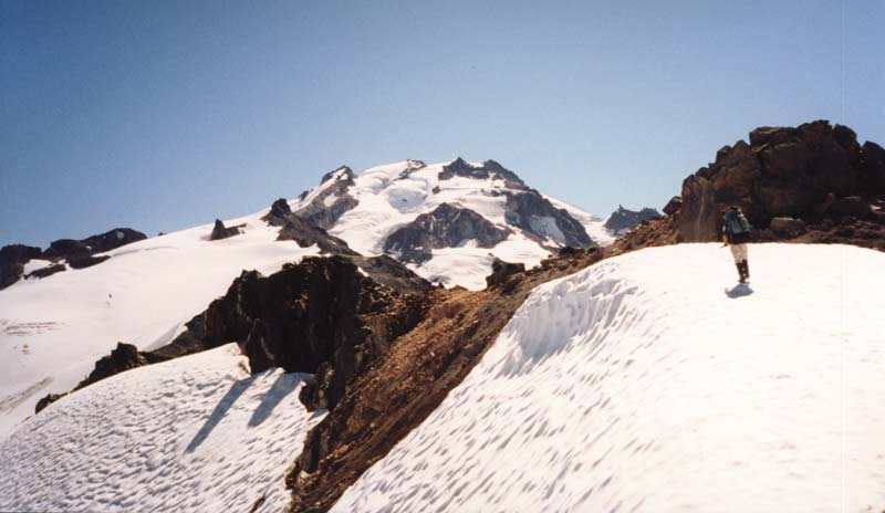
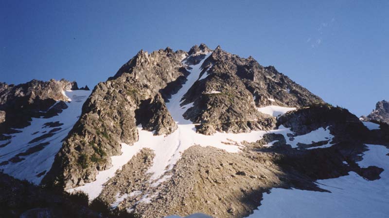
Glacier Pk. We ascend the Chocolate glacier on the right side then descended along the left sky line. |
Andrew at the brink. |
Back at camp we both feel wore out by the day and decide to stay here one more night. I
gather some firewood and after dark we make a small fire and sit out to enjoy the evening.
[3,500 gain, 3,370 loss, 10 hours]
Another leisurely morning. From our camp at the tarn we traverse east, gradually gaining elevation to eventually pass below a large rock ridge (about 6,000 ft) and cross a stream. We ascend meadow slopes to a lake at 6,400 ft. which we circle to the south side. We climb up to the divide between Suiattle and Napequa valleys. From there we try to traverse slabs toward the Butterfly Glacier and that does not go well. We split off and both end up climbing too steep slabs with too much exposure. Better to go directly up to about 7,500 ft to pass above slabs.
We continue to contour around basin (head of Napequa River) and onto Butterfly Glacier. The snow is alternately soft then icy and I find that my patience for poor footing on snow is very small today.
From the east side of the Butterfly Glacier we cross another ridge at 8,000 ft. Our plan is to continue on the glaciers of the Clark range crossing the Pilts, Robers, then Clark (Walrus) Glaciers. But we are confronted with the steep headwall of the Pilts. Not worse than yesterdays climbing and we would only have to go up. But today we have full packs and no stomach for steep snow. We consider descending into the Napequa the back up over Bolder pass, but that seems like a lot of work.
So, instead, we cross the crest of the DaKobed range to the south slopes on which there is supposed to be a high route near 5,500 ft. The difference between the north and south slopes is dramatic. South of the crest there is no snow. The slopes are steep, but not precipitous. We traverse down to a little flat spot in a ridge which looks like a feature described in the high route. There we settle down for lunch and are beset by bugs. Mosquitos, black flies, and horse flies: the are all here and they are all ravenous. This is terrible. Lunch is barely tolerable.
We descend into a basin then pick up a faint track on the other side. Then we loose the track and head up a steep forested rib. Soon we are climbing 60 degree forest by roots and twigs, God help us. But we come out the other side in a wondrously beautiful high grassy meadow dotted with small pines and find that we are on a decent track. This leads us over another rib into another basin. At the far side of that the trail descends and enters brush. It looks like it's heading down to the White valley and I suggest to Andrew that we do that ourselves. But he's worried about getting stuck in steep brush hell (wise).
We do follow the trail down into the brush. Then it turns and starts climbing toward the final ridge to Bolder Basin, which is our destination. We have descended several hundred feet and now must climb 1,500 ft. or more. At first the trail is OK, then it dies out, leaving us to cross difficult steep slopes then grind our way back up toward the crest. My pack is heavy, I'm covered with sweat and dust, the bugs give me no peace even while walking: this is hell.
I catch up to Andrew at the crest but we cannot have any rest here for the mosquitos. We descend quickly looking for the first flat spot with good water. In a near frenzy we erect the tent, throw our gear in and I dive in. Andrew heads off to find water for a rinse off. We both lay in the tent reading and relaxing. After dark I venture out, find the bugs gone, and cook dinner.
On nights like this I really appreciate the netting top of this tent. It provides perfect bug shelter but I can lay in comfort and watch the stars spin around the sky.
[250 gain, 3,500 loss, 3 hours]
The bugs are up before we are. We dive out of the the tent, pack in a furious scramble, and are off down the trail. It's all down hill today, just a matter of putting in the miles. We hope for a bit of a swim in the White river to wash off yesterday's dust.
When we get to the white river the bugs are without measure. After the shortest break we are again walking toward the trail head. As I walk I'm constantly swatting bugs from my arms and face. As soon as I clear one side of my arm I turn it over and have to clear the other side. We can not even keep up. We stop and throw on our rain jackets then continue walking. We pass several people on their way in. I don't know how they are going to survive. I now think that it is a good thing we did not drop into the Napequa, we may not have gotten out alive.
Finally, we are at the car (no bugs here), then a restaurant, then home.
Trip total: 20,100 ft gain, 19,000 ft loss.
[Back] [Home] [Trip Journals] [Climbing] [Kayaking] [Flight] [Photos] [Food]
Page last modified: Feb 01 00:45 2003 by Tom Unger