[Click for more detail]
Andrew and I fly from Seattle to Salt Lake City. We rent a car and drive south. It is dark by the time we are in southern Utah and we pick our way along the back roads to the trail head. We sleep out under the stars.
|
|
|
|
|
|
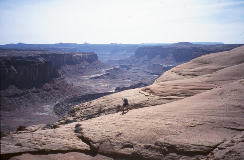
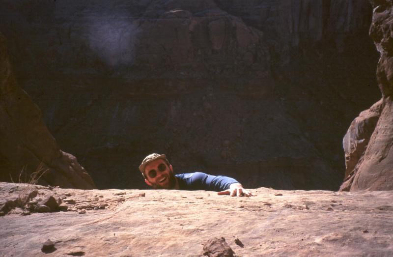
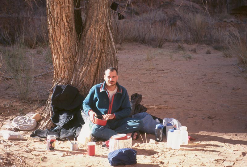
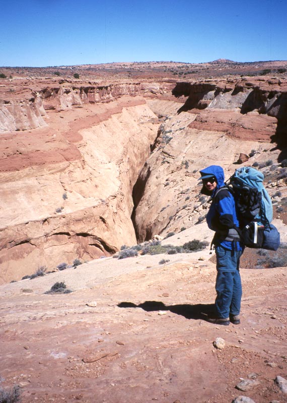
We realize that we forgot to buy any fuel for the stove and have to drive back into town. The aesthetics of our in-the-dark arrival is broken. But soon we are back and ready to hike. From the rim we descend slick rock ramps to a ledge on the side of the canyon. We follow this ledge north, winding in and out of a few small side canyons (galleries). At the head of one side canyon the rubble has built high enough to provide a path down into the floor of the dirty devil.
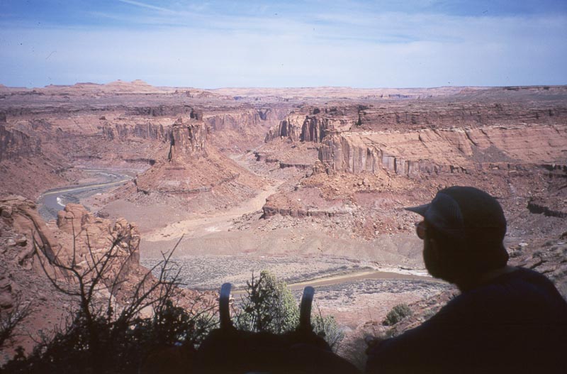
The river owns it's name. The water is gray and full of sediment and an unpleasant odor rises from it. It was named by Powel's Colorado River Expedition, the first party of new American's to descend the river. The Colorado was itself quite murky and was none too good for drinking. Each small tributary was eagerly awaited as a potential source of clear flowing water. When the expedition arrived at this river one guy in the back of the boat called out "How is she". The answer was "Aww, she's a Dirty Devil."
We change to sandals and pick our way across. On the far side we discover a canoe and camp, but no campers. We hike a little distance up Twin Coral Box Canyon then camp. We head further up canyon looking for water. The stream bed is wet as if it recently held water. There are patches of dried white salts on the ground and rock. When we finally find a pool of water it is heavily mineralized and none too pleasant to drink
Hiking further up in to the canyon we meet the two who camped at the river. They are both BLM employees doing a little semi-recreational canyon exploring. We talk about the legal status of these canyons and what can be done to protect them. They are currently not protected in any way, but are included in all plans for wilderness protection in southern Utah. After the trip I write to the BLM and suggest that these canyons and all the way to the Canyon Lands National park be protected as wilderness.
|
|
|
|
|
|
We hike north cross country, following an old road at times. After a while I notice that there are more signs of animal traffic than human traffic. The road is generally very clear, but clearly has not been driven for a long, long time. After some human use this land is returning to a wilder state and I feel very privileged to be here.
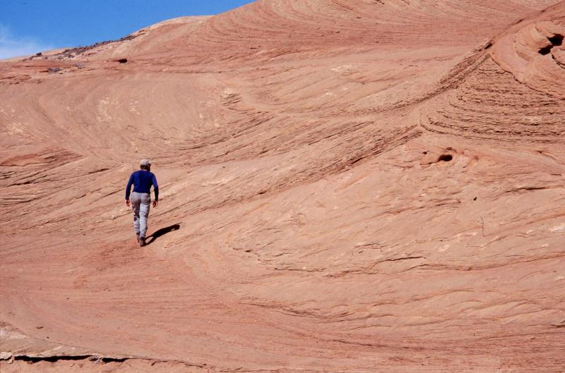
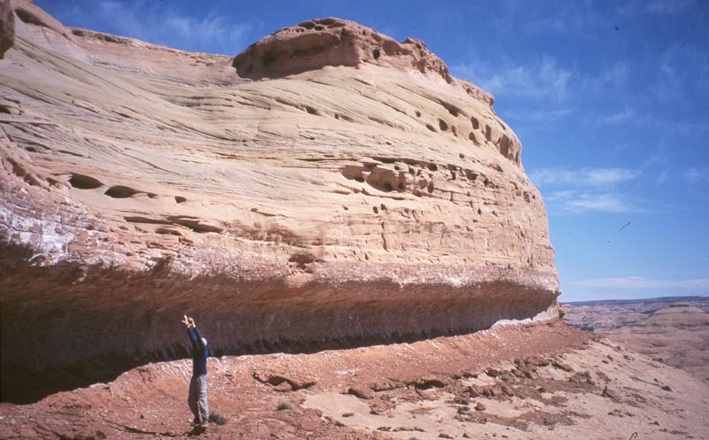
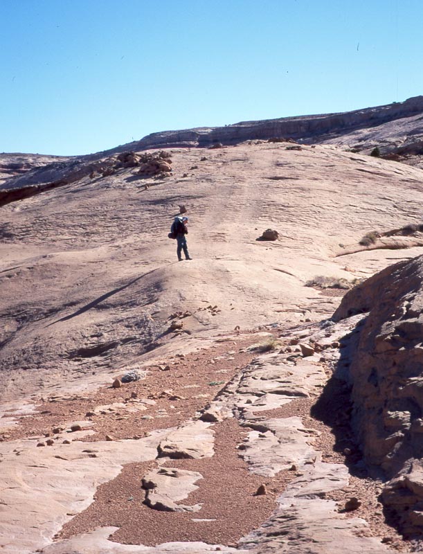
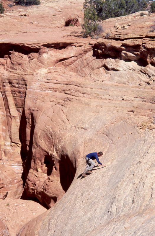
Mid day we drop our packs and hike up one of the large sandstone domes. Going up we are moving through a sea of rock. At the top we climb some ramps but then find our way to the very top blocked by an impassible overhang.
We come back to the Dirty Devil canyon rim and wind along it a short ways. We then drop into a small side canyon, walk down to where it cliffs out. We walk out a small ledge to one side where we can step down onto a tallus slope and descend to the Dirty Devil again.
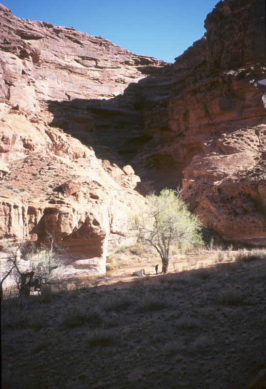
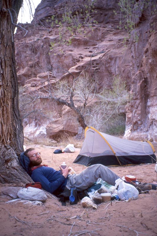
From there we start walking up Larry's canyon. The miles turn into a chore: this is a long day. Finally we come to a spring and a good camp site. The water here is significantly better drinking. We spread out under a tree, break out the whiskey, and cook a good dinner.
Late that evening I get out of the tent to pee. Standing out there I notice that the moon has disappeared from the sky. It's full, and just a shore while ago it was flooding the canyon wall with moon light. We remember that it is a (full?) lunar eclipse tonight!
|
|
|
|
|
|
|
|
|
|
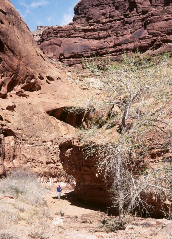
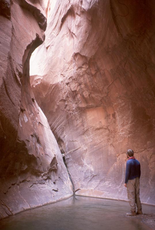
The right fork is very beautiful. The trees are still bare from winter and last summers leaves are on the ground crisp and dry. The canyon ends in a 30 ft cliff. In the cliff is an interesting alcove. A large room really, where the water has carved a narrow crack and left a pool. I'd be content to turn around here, but Andrew wants to go on and thinks it would be OK to climb the crack. We strip to our underwear, wade through the pool, climb the crack then the chimney above that. Above there we walk further up stream, barefoot and half naked, only to find a truly impassable cliff 100 yards further up canyon.
|
|
|
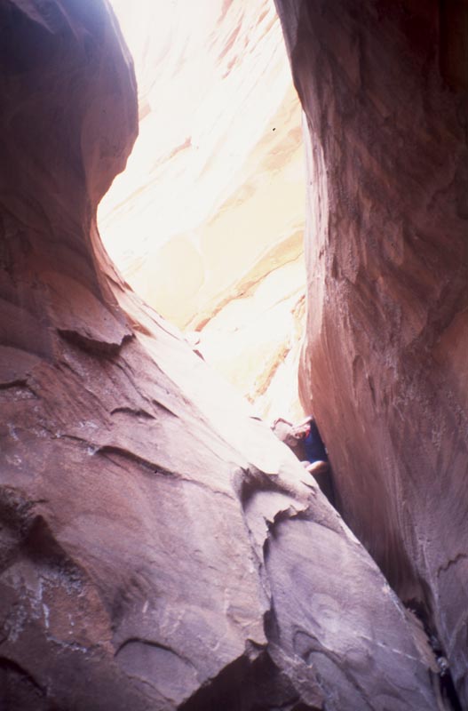
Reversing the moves is interesting. The chimney is easier than I expected but the crack is awkward. At the bottom I reach a position where I'm stemming between the two walls just above the water. I need to shift my weight on to the left wall where there is a small ledge I can walk out to the shallower part of the pool. I work at it for a while, feeling I could drop into the cold depths, then find just the right shift and the move is easy.
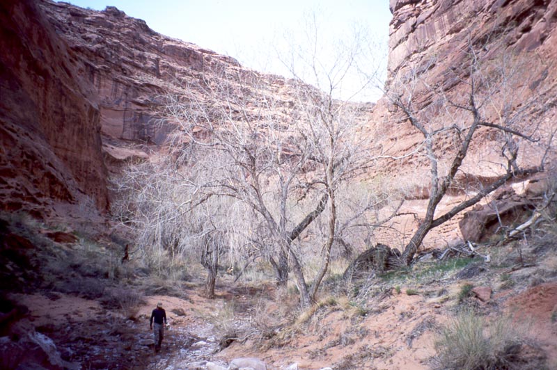
Early afternoon we pack camp and grind our way up out of the south side of Larry's canyon. We climb a steep slope, walk along a small side canyon, pass a small saddle and find ourselves in a broad valley. The weather is changing: there is now a strong wind and a bite to the air. We hike east through the broad valley. The floor is sandy and the going tough. A the far end we climb out of it to the north and find a camp side on the south rim of Larry's canyon.
We set up the tent, carefully guying it out with webbing and rocks. I decide to rest in the tent for a while and find conditions to be miserable. The wind is picking up the fine desert sand and driving it under the tent fly where it comes through the full netting roof and settles on me. Every 10 seconds a gust bring a new load of sand into the tent. After 10 minutes there is a fine layer of sand on everything. I get up and tell Andrew we have to move camp. He's skeptical, but goes into the tent to pack his sleeping bag. When he comes out he observes that it is like a sand blaster in side the tent and that all thoughts of a comfortable night here have been obliterated.
|
|
|
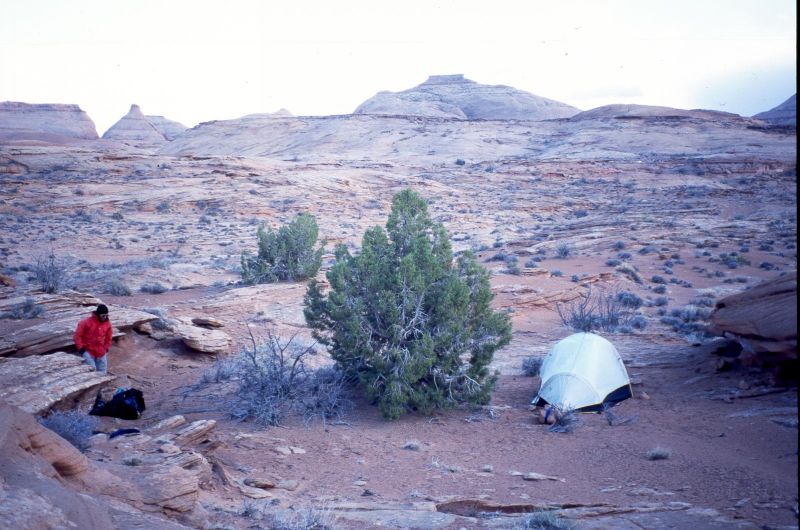
We hike up a near by sandstone knoll. At it's far end we find a sandy bottom alcove that is very well protected from the wind. We set the tent up with out the fly and enjoy a peaceful night of star gazing.
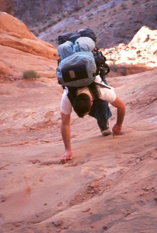
We start the day following another old road. In many places it is no more than two tracks worn in to the sandstone, and clearly has not been used. We are working toward a yet-higher bench. Once on that we join a modern dirt road used by ranchers to move their cattle and stuff like that. We follow that a ways west, then turn off it and head north cross country toward the head of Larry's canyon. We are walking in sand and going is slow.
|
|
|
|
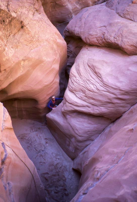
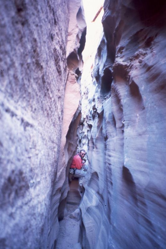
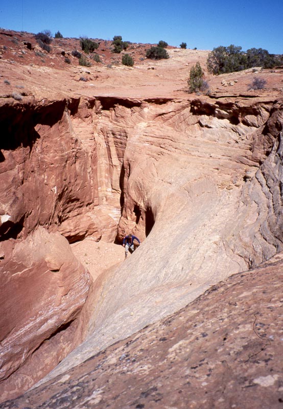
Upper Larry's is perhaps 75 yards wide with convex walls sloping down to a narrow slot. Looks interesting so we contrive a way to get into the canyon. At the head of the canyon we anchor our climbing rope to a couple shrubs and rappel down, about 100 ft below the head.. The very upper part is round holes connected by narrow slots, all carved as interesting swirls in the sandstone. Walking further down the canyon we come into narrows, perhaps two feet wide.
|
|
|
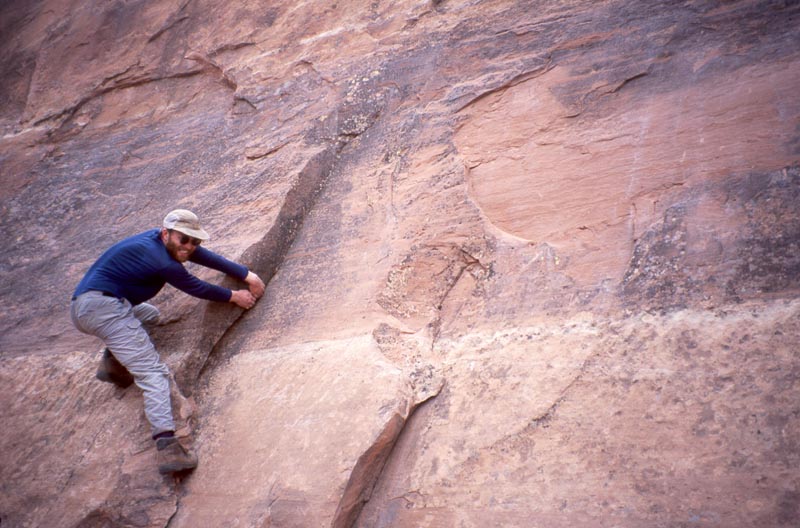
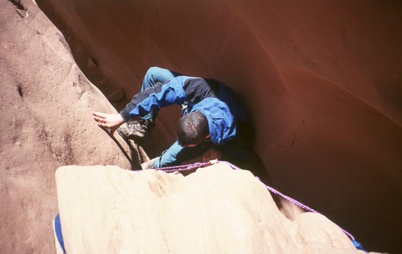
The narrows are blocked by occasional chock stones. Upstream of the chock stone the canyon tends to be filled with sand up to the level of the stone while downstream there is a 5 to 15 ft drop. The first of these gives us pause. We have both done some chimney climbing, but not very much, and don't want to end up stuck below something that we can't reverse. We sling webbing and rope around the chock stone so that we can grab it from below, insuring that we will be able to climb back up. The down climb is easier than I expected and pretty soon I am very comfortable stemming up and down the slots.
|
|
|
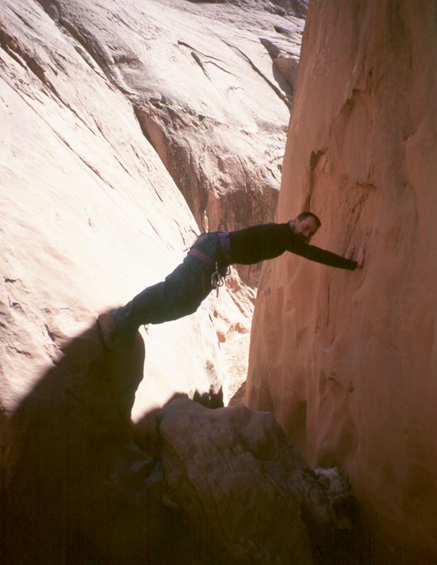
We descend several hundred yards of narrows with several chock stones. We encounter water and chimney over than then are stooped by a wet drop. We reverse the route with no problems and then explore to the very head of Larry's. There we find that we can easily climb to the first hole in the canyon. From there we can climb to the base of a slab. The slab is steep, and would be difficult friction climbing except for a set of Moki steps carved into it. Moki steps are small depressions carved into rock by early inhabitants. It is my impression that these may have been carved 700 years ago. The depression provides just enough friction that it becomes a moderate friction climb.
|
|
|
From the head of Larry's canyon we pick up a modern dirt road and hike along it for several miles. We leave the road and work our way cross country (more sand!) toward Robber's Roost where we will camp. Our last water was in Larry's canyon and our next will be at our camp tonight. Feeling this pressure we have been pushing pretty hard to get there or get lost with plenty of daylight with which to find it. Finally, when we come around the last bend that confirms where we are I feel so wore out that I just have to sit down and take my pack off. I look back to tell Andrew that I have to take a rest only to find that he has already dropped his pack and is sprawled across it.
Robber's Roost got it's name because Butch Cassidy and his gang would camp out here. Now it is used heavily as a watering hole for cattle. There are foot prints and manure all over. Fortunately someone (maybe 80 years ago) built some wood troughs to catch the fresh water from the spring and they seem to be clean. Still, we filter then iodine the water. That evening we camp on a near by hill top to be away from the smell.
Dinner is fresh baked foccacia and pasta. The moon is past full and won't rise till a couple hours after dark, giving us some excellent night sky viewing. The commit XXX is clearly visible. This has been a astrologically interesting week.
[Back] [Home] [Trip Journals] [Climbing] [Kayaking] [Flight] [Photos] [Food]
Page last modified: Feb 01 00:45 2003 by Tom Unger