| Galeries: index/Flight/FlyingUtah06 |
(Click on thumbnail for larger image)
On Thursday March 30th I loaded my plane and took off for Utah. Unlike last year I faced some bad weather blocking crossing of the cascades. I flew down the I5 corridor to Portland with 2,500 ft ceilings, through the Columbia gorge with light rain, then across Oregon to Battle Mountain, NV where I spent the.
March 31st brought low clouds. At 1 pm I thought they had lifted a little and took off. They had not lifted much, but most of the country side provided excellent emergency landing opportunity so I felt comfortable pressing on. I eventually made it all the way through the Salt Lake basin to be stopped by the final mountain crossing into Southern Utah. I spent the night bivied in the small pilot lounge at Spanish Fork.
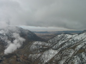
Worse weather was forecast for April 1st. I was afraid that Marshall would depart Seattle after me, ride in slower transport, yet arrive before me. Early morning reports from Price, just over the mountains showed decent conditions. The crossing was good except for the final drop into Price which was done in a valley capped with clouds. I had arrived
|
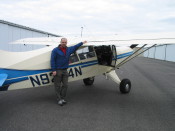
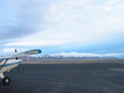
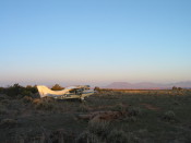
Plane loaded and ready to go. | |
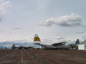
Big firefighting airplanes at Burns, OR |
|
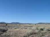
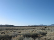
Eastern Oregon scenery. | |
|
|
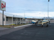
Battle Mountain. | |
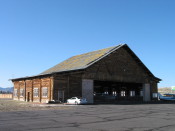
I camped just outside the FBO. Rained all night. |
|
Low clouds on my way further east. | |
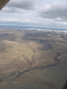
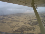
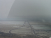
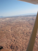
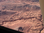
The final pass as I drop down into the Salt Lake basin. The great salt flats strech out before me. |
|
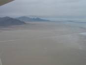
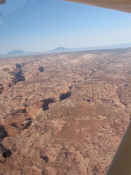
The salt flats. | |
|
|
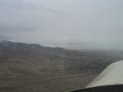
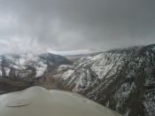
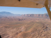
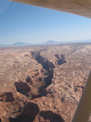
The final canyon before arriving at Price and southern Utah. | |
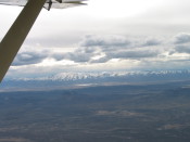
Though the clouds are low I can see that beyond the sky opens up. |
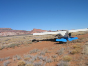
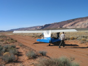
Marshall, Jeff, and I rendezvous at the Hanksville airport. Early Sunday I fly them out to reconoiter the southern section of Capitol Reef where we plan to do some exploritory canyoneering. There is a landing strip on Big Tom Mesa, near the trail head, but I decide the road looks better. This is my first road landing. The road is just wide enough to turn the plane around
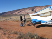 |
Explaining the plan. | 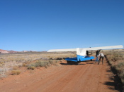 |
I pull, Jeff pushes. |
 |
Snug it up against the bank. | 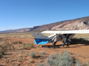 |
The tail just fits. |
 |
Line it up. | 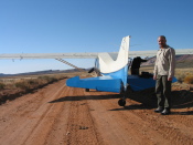 |
Ready for take off. |
After our trip to Capitol Reef I did a flight out to land on the road at Burr Point. The landing went well but I then bumped a post with the wing tip. This shut down flying until I was able to get the plane to Moab for an inspection and field repairs.
 |
The damage. |  |
The dam post. Only thing that tall for miles. If I had only been paying attention. If I had only turned around before the post... |
So I then spent the week with kids from Post 84, movied the plane to Moab on Friday, and had repairs done by mid day on Monday. Monday was so windy that I was glad to have my plane in a hanger. A Cessna parked outside was flipped over by the wind. The mechanic was unwilling to even open the hanger door.
Due to the wind I thought my friend Steve was unlikely to arrive. Surprisingly his plane, a commercial flight on Salmon Air, touched down at 6pm, a little late but impressive. Steve said the fight was not so bad and the landing much smoother than expected. We bivied in the maintainence hanger.
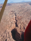
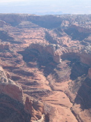
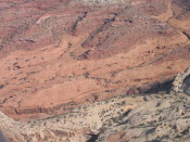
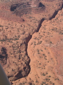
Early the next day I took Steve and Bruce, a photographer for SUWA, up to photograph oil development encroaching on potential wilderness areas in the northern Desolation Canyon area. The flight was beautiful but the air was still bumpy. On the way back to Moab both Steve and Bruce had vomited. Steve and I then hung around the airport waiting for him to recover and the air to settle.
Mid afternoon Steve was game to go. We choose Mineral canyon which would be an interesting back country strip but was also very close. The strip is in the bottom of a canyon. I landed to the north which required me to fly base right up against the canyon wall and make a sharp turn to a very short final and landing. No problems at all.
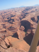
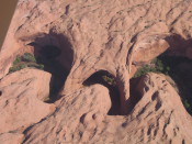
To avoid further motion sickness incidents we decided to get up early and fly in the mornings. We were out of Mineral canyon by 6:30 on Wednesday and had a beautiful morning light flight south over canyonlands and down to the Dark Canyon landing strip. No photos becuase...well, I've not been much into bothering with the camera. We hiked around the head of Bodie canyon looking for some ruins, then crossed over to some other ruins I knew of so that Steve could see them.
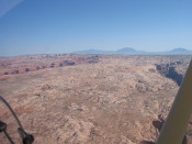
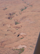
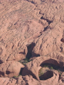
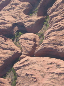
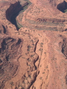
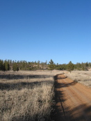
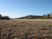
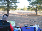
Thursday we flew down to Hall crossing then slowly up the Escalante, one of my favorite parts of southern Utah. Stopped at the Escalante airport for lunch but didn't see much to keep us. On to Bryce. From the Airport Directory description I thought Bryce would be a whole lot busier than it is. Only way to get to the park was to rent a car. When I realized this would let us camp out in the forest I liked this idea. I don't ralize it, but weeks away from trees and I miss them. The high grassy valleys and open pine forest around Bryce was one of the most beautiful things I saw on this whole trip.
Back to Gallery Index
Images © 2010 Tom Unger
[Back] [Home] [Trip Journals] [Climbing] [Kayaking] [Flight] [Photos] [Food]
Page last modified: Sep 05 19:07 2010 by Tom Unger