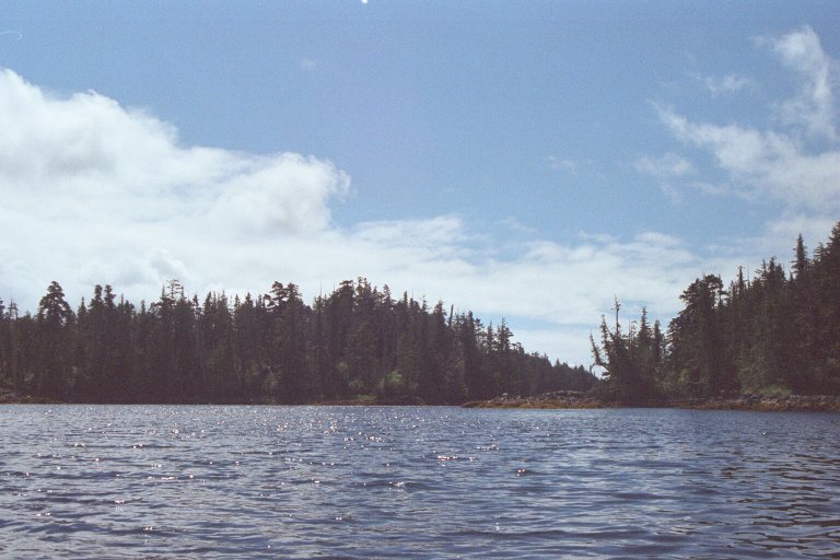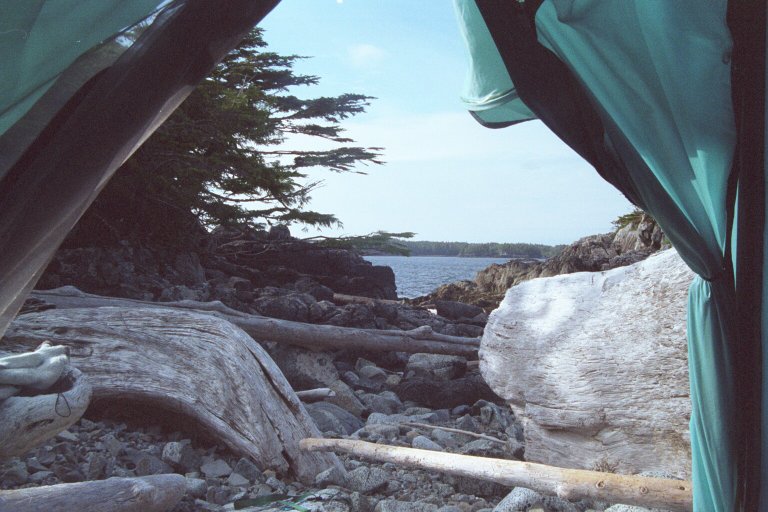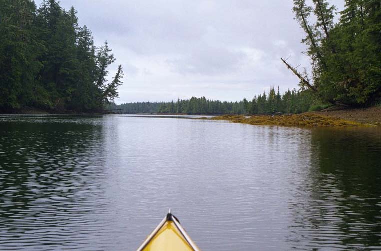
Entering Gail Passage
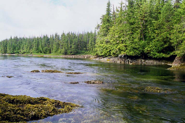
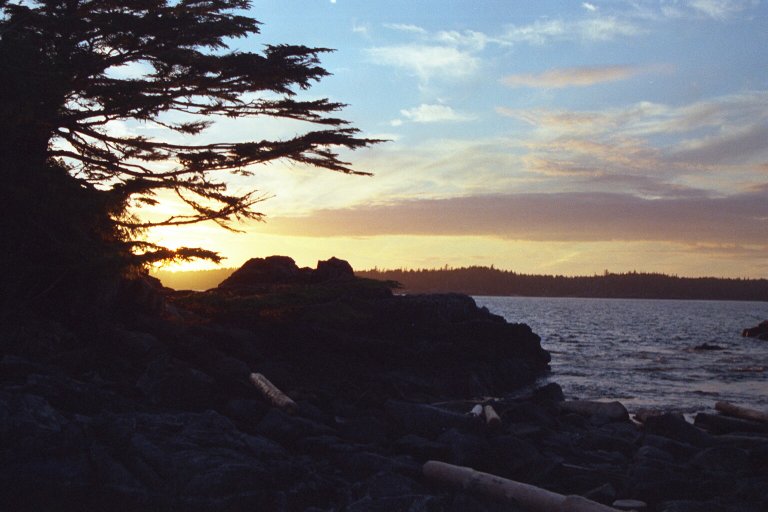
The tidal rapids.
[Previous] [Hakai Index] [Next]
Drizzle AM, Cool - Clearing at noon - Sun and sparkling afternoon
Paddle 10 NM in HR.
Still light drizzle when I get up. Lug all my stuff back to the boat and out on the water by 9 am. Crossing Seaforth channel is easy - very moderate waves and no boat traffic.
Gale passage is very different than other places I've paddled. Feels like a creek more than a salt water channel but it has all the salt water vegetation. In the middle the chart indicates "tidal rapids", which worry me. When I arrive I land and scout them from the water. Looks like a short fast section of a river - nothing challenging at all. I go through once, paddle back UP through the rapids, then through again, cutting over the eddy line to see how that feels.
|
|
|
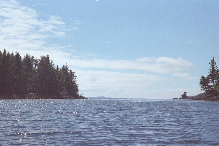
From here my small channel opens up. I turn left and paddle through more small channels, this time going against the current. The channel opens up again. This feels like I'm paddling through a chain of lakes and streams. I paddle across one bay and find a creek I saw on the map. After filling water I walk up stream a short ways. All morning I've heard small fresh water creeks and getting water would not be a problem.
|
|
|
|
|
|
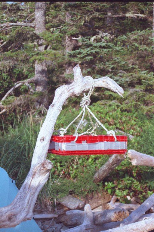
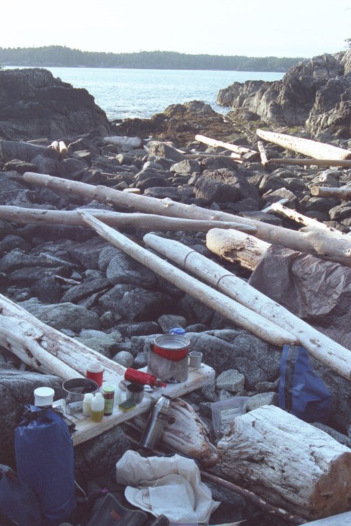
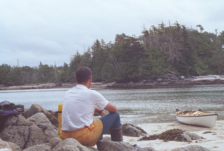
It's easy to find a place where I can get out of the boat. The challenging part is securing the boat. Dragging a loaded boat across sharp rocks will scrape the shit out of it. Leave it in the water and it will bang around. Worse, the tide is usually coming or going so any solution is temporary. Today the tide is going. I pull the boat up and lay it gently on the rocks. But every 10 minutes I have to go down and easy it out a little. If I don't it will end up well beached on the rocks and I'll have to empty it before I can move it back to the water.
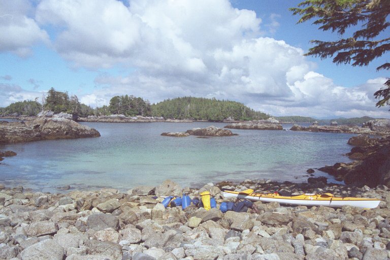
After my break I paddle west through Waskesiu Pass. This opens into a small bay with several small islands and open ocean beyond. I pick one of the islands and land in a protected lagoon on the north side. The lagoon has a white sandy bottom (but rocky shore) and sparkles light green in the sun. I've learned a little about looking for good camps: small islets with a drying bar connecting it to the land may have good camping on that, provided the bar is high enough.
I'm learning to predict tide height by looking at the bands on the rocks.
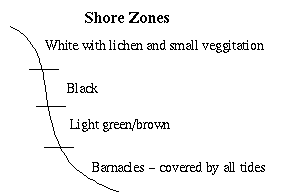
In inner passages these zones are quite distinct but on shore lines washed by wave action they are less distinct. The barnacles get covered by most high tides. This is the line of barnacle proliferation, not scattered barnacles in shady spots. Above that is a lighter band. Last lights high neap tide (13.6 ft.) covered about half of this.
Next a black band. This is about the 15' mark. I think this gets reached by most full moon tides and covered by most new moon tides (~17 ft.).
Finally, more white rock with lichen and some green grass. This probably only gets covered at extreme high tides or washed by large waves.
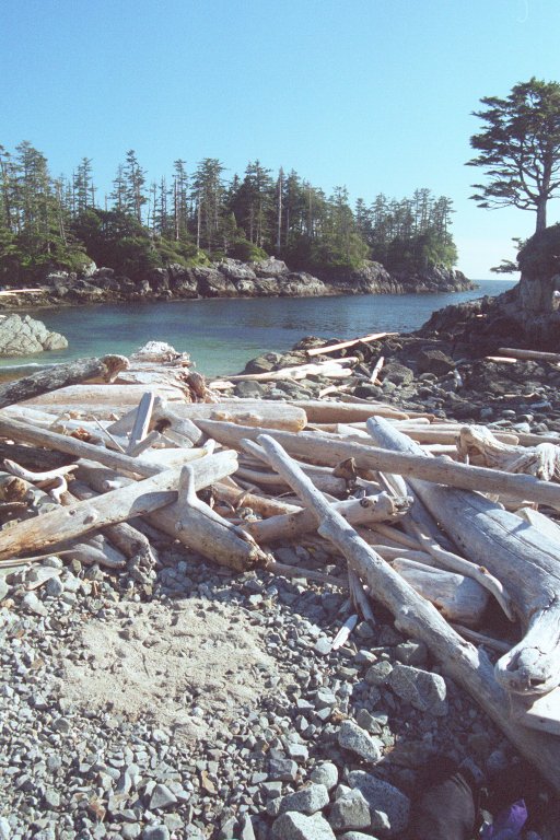
So, on my island I find some very nice sand high on the bar, and a small space among the drift wood up near the vegetation. My guess is that neither will be covered tonight. But, unsure, I choose the higher and set about making it comfortable. I clear out the large rocks and level 1 sleeping space. I haul up 4 loads of sand for fill. I could sleep on the rocks, but it is easier on the equipment to have an even sandy bed.
The tide rises to just below my predicted mark and everything stays dry.
|
|
|
|
Sun early - Clouds by 9:30 am - Clear PM
Day Paddle
Bah! Clouds are back.
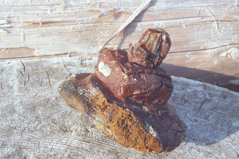
Sleep late, stay in camp reading. Latter I walk to the south end of the island which is a beautiful wind blasted rock. On my way back I gather some beach debree and create art.
|
|
|
By 2 it's clearing and by 3 I'm on the water heading west. Open water with 2-3 ft. waves - nervous at first but everything feels under control. Very exciting to be out here really. And very beautiful. Turned out to be a crystal day.
I find a sandy beach on an outer island and stop. In the trees are ruins of a lean too and overgrown trails. Would make a nice camp now, and is in a stunning position.
|
|
Back at camp I cook bread for dinner. Tides are getting large and latter. Midnight tonight. I walk around at 11 p.m. and see I still have 4-5 ft. before my gear would be touched. I'm very protective of my kayak. I'm very dependent on it to get my home.
Marie, Paul, and Wendy show up in 3 days. Tomorrow I start heading back to meet them. Rain heading this way too so could be some unpleasant days.
Cloudy, occasional drizzle - Rain evening - Sea Otters
Up early and in boat paddling. I round the south end of Princess Alice island and paddle through the Houghton islands. More open water paddling. I drift in the kelp feeling the power of small swell moving under me. So much life out here. Very privileged to be here.
 I cross Thompson bay to the south end of Louise
channel. There, on an island, is a marked camp site which I hope to camp at later with the group. First "official"
site that I've seen. Sandy beach landing, kitchen area with driftwood furniture, trails to forest tent sites. We'll
come back.
I cross Thompson bay to the south end of Louise
channel. There, on an island, is a marked camp site which I hope to camp at later with the group. First "official"
site that I've seen. Sandy beach landing, kitchen area with driftwood furniture, trails to forest tent sites. We'll
come back.
Back in narrow channels. Quite different from open water. Beautiful, but not as wild. See a sea otter in Louise channel.
Stop at 1 p.m. at marked site in cove on Potts island. Not much sign of use - no established tent site except for grassy area which will flood tonight. Near by I find a high part of the beach, kind of an alcove in the forested bank with a smooth pebble floor. I level the pebbles to make a nice site tucked back.
I set up kitchen near by and settle in for an afternoon of reading. It is not long before the rain sets in. I scurry around setting up the tarp and soon have a secure, if not snug, place to sit and read. Rain lasts through dinner.
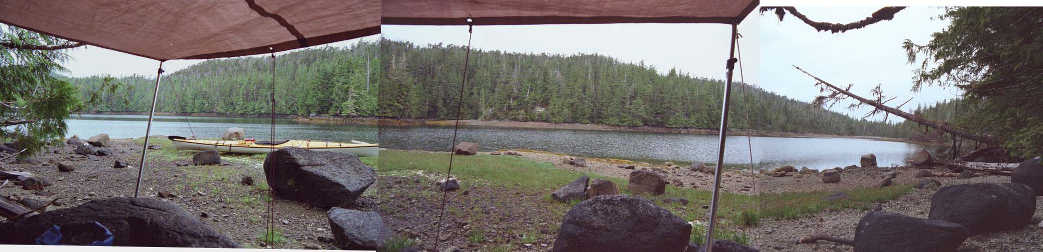
6 p.m.: The view from under my tarp
After dinner I walk along the waters edge and look at the wild life. There is an incredible number of hermit crabs. I see them at most beaches, in varying densities. There are also purple shore crabs, but they are less common here. I notice that places where I previous stepped on and crushed barnacles have drawn a lot of crabs to scavenge. I go back to camp to get a cook pot. In it I gather several hermit crabs, one purple crab, and several barnacled rocks. I crush a few of the barnacles, then sit and watch how these animals interact.
Now I'm sitting in the tent watching the water creep toward me. 2 hours till high tide at midnight. Think I'll be OK, or I wouldn't have set the tent here. But I won't sleep soundly till then. Ready for a dash up into the forest and have a flat spot picked out. It is tempting to just camp in the forest, but that would leave a lot more impact. Traces of my stay at this tidewater camp will be gone in a week.
Overcast - Clear by evening
Paddle 10 NM
Made it with feet to spare That would put this camp at over +16 ft. No rain last night.
Marie, Wendy, and Paul depart Seattle to drive to Port Hardy today. I'm excited to see them.
Paddle north through Joshua Channel then Rait Narrows, returning to Seaforth channel. I expect the current in Rait Narrows to be with me but it is against me. Paddle for a solid 2.5 hr before needing a break.
Check out a marked camp near horse pt and end of bay with tent sites in trees. Should be OK, but the outer islands are more beautiful. Take a long break here before I get myself back into my boat and paddle on.
That afternoon I Camp is in a popular bay called Kynumpt Harbor, north of Bella Bella. I expected other campers, but find none, nor signs of camp sites. I find a place where two large pine trees are growing just above the high tide line. There is good flat tenting ground near their trunks and their branches reach out and shelter a portion of the gravel beach where I make my kitchen. This is the first time I've slept clearly above the high tide line.
I latter learn that just near here is an overgrown field where there was some sort of settlement.
This evening I again poke around at the waters edge looking at the crabs. Lots of hermit crabs here. There seem to be two sizes of shell available to the local crabs, with a big gap between, and a shortage of the larger shells. As a result, there are many crabs that don't fit into their shells any more. I collect a few in my pot and watch them.
Sitting cooking dinner I see two inflatable boats come into the bay and scan along the shore. Each boat is filled with equipment and carries three people. They stop in front of my camp and ask about fresh water. A foreign accent, perhaps French. Traveling the coast in open inflatable boats seems like a crazy French idea. I tell them I've not seen any good fresh water streams in this bay and soon they depart, heading west.
Latter I see a string of identical little speed boats pass the bay entrance. How bizarre! Could this be a club touring the coast in small open boats?
Rain off and on
Day in town, meet ferry
Paddle into Bella Bella in about 2 hours. The town has a large central pier with floating docks on the north and south side. I land on one of the north side docks which is old and greasy. I pull my whole, loaded kayak up onto the dock. I organize my stuff, seal the kayak, and leave it for the day.
I ask at the gas dock office about showers and am told to go to Sherewater. The attendant is not particularly friendly. I got up to the band store, but there's not anything I need. It's raining steady now but there is no place dry for me to hang out it. Not feeling particularly welcome around here I wait on the dock for the shuttle.
I'm the only passenger and Glen, the driver, invites me to sit up in the wheel house with him. Glen moved up here 3 years ago. Says he's always been able to see auroras and do energy work. Tells me some of the local gossip. Turns out next ferry is at 5:30 so I'll end up spending most of my time in Sherewater. That is just as well, for what ever reason I feel more welcome there.
Showers are great. First time I see myself in days and I'm looking good.
Get a beer and burger at the restaurant, both of which taste great. Pacing myself, I'll get a slice of pie latter.
I discover that the string of identical small boats I saw yesterday are part of the Sherewater fishing lodge. Fishermen fly up here, stay in the shore lodge, then go out each day in small boats to fish. There are also a couple floating lodges in the bay. These are larger boats, some converted tug boats, set to carry 6 or 12 fishermen in reasonable comfort. They tow small boats behind them as they make regular rounds of the popular fishing grounds.
I'm told that the village elders never saw this much rain in a summer. This is a historical event I'm part of this summer. Yippie!
Ferry back to Bella Bella feeling clean and carrying a bag of clean clothes.
I paddle 20 minutes south to the McLaughen bay ferry dock. I land in front of the Sea Quest tourist house. Sea Quest is a native run tourist service. They have tent sites near by, offer a kayak shuttle service, and a few other things. Their building by the ferry dock is a demonstration hall, museum, and store. There are historical photos and displays along the wall, seats along another, some instruments, and a sales counter. The walls are loose wood planks and the floor a sand made from ground sea star and sea urchin shells. Inside several candles and cracks in the wall provide a diffuse light. It has a very nice feeling. The Sea Quest folks are waiting for the ferry. Passengers may sign up for a short lecture then paddle a native canoe from here to Shearwater, which is the next ferry stop. I arrange for a tent site for the night and then hang out waiting for the ferry.
When the ferry arrives I stand at the head of the ramp and look for my friends. I am thrown off by Marie wearing one of the new Patagonia jackets, a bright orange which I don't recognize as her gear. Then they wave and I know: Our plan has worked, we are all here. I'm so eager to see them that I open the gate to the ferry ramp and get a disapproving look from someone in uniform. No matter.
We chat, and haul boats from the ferry to the Sea Quest hut. There boats are all loaded with gear and quite heavy to carry. We set up camp just beside the hut, on the nice coarse sand. Pretty quickly we have gear spread all over the place. I was having enough trouble keeping track of my gear when it was just me. Now I desperately try to keep my gear piled together, separate and organized, but it is a loosing battle.
We stay up late, then sleep. Rain during the night.
[Previous] [Hakai Index] [Next]
[Back] [Home] [Trip Journals] [Climbing] [Kayaking] [Flight] [Photos] [Food]
Page last modified: Oct 07 22:54 2025 by Tom Unger