|
|
|
|
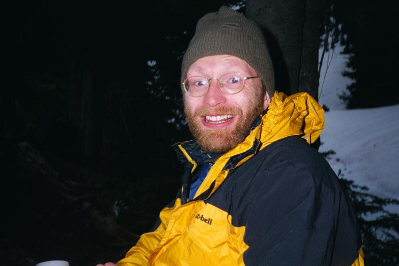
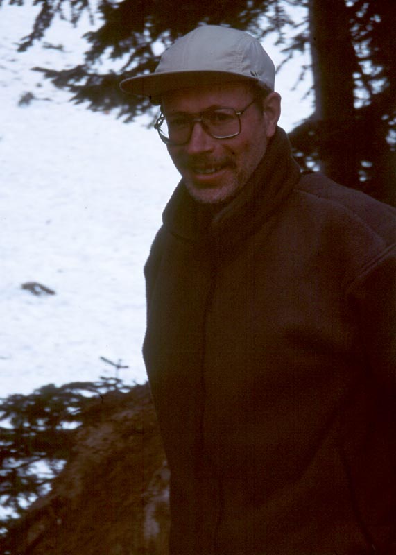
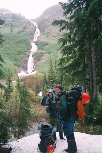
Photos by Tom Unger, Michael Scott, and Sean Sirutis.
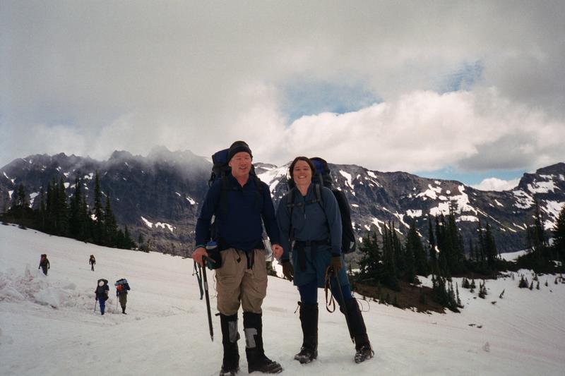
In 2000 Marie and I lead a Mountaineers Basis Climbing Course Mentor Group. One of our group activities was a basic climb. Of course, we didn't want to take them on just any basic climb, we wanted to do something special. We decided to climb Clark Mountain, but then descend into the beautiful and seldom visited Napequa valley and come out over Little Giant Pass. I imagined a beautiful climb of Clark, followed by a chance to camp on Butterfly Butte and spend a free day exploring the headwaters of the Napequa. I had been to or near most of these places and was excited about linking them all together in one trip. I started calling the trip the Clark Mountain Extravaganza.
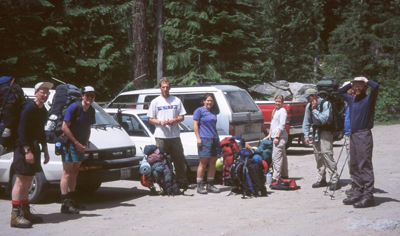
Leaders: Tom Unger, Marie Mills, Andrew Boudreaux.
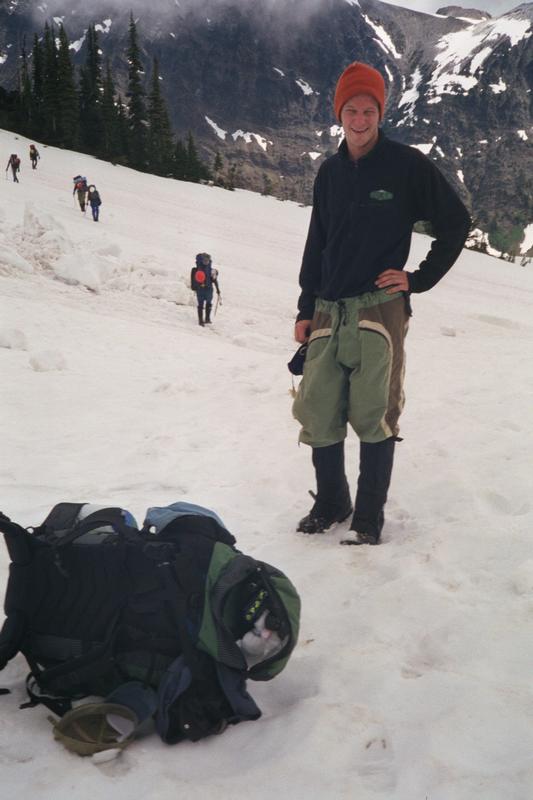
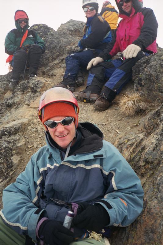
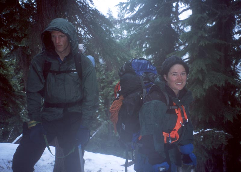
Students: John Augenstein, Elizabeth Barnett, Andreas Enderlein, Thomas Hodges, Michael Scott, Sean Sirutis.
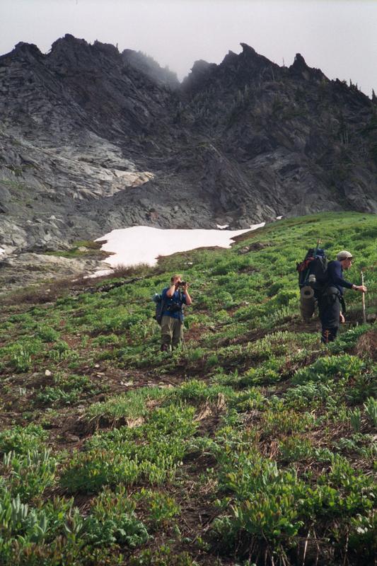
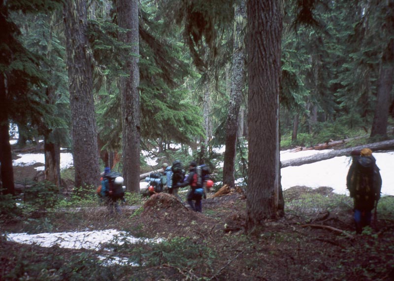
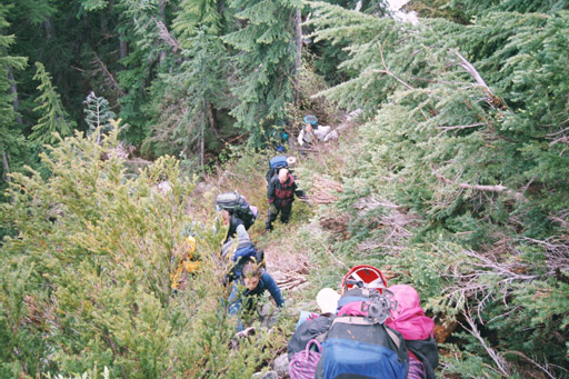
Set up car shuttle. Hike White River to Bolder Basin.
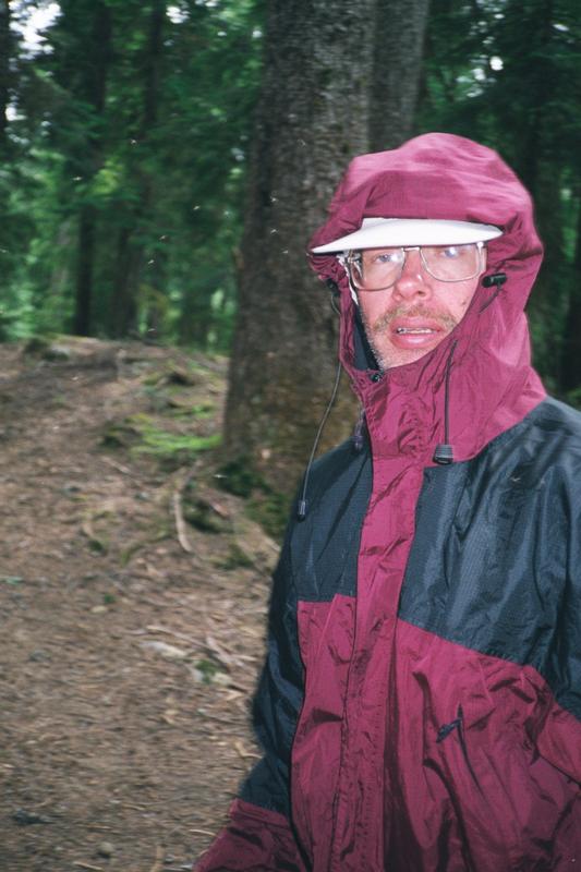
We spend the morning planting cars at our exit location at the Little Giant Pass trail head, then drive over to the White River trail head. As we load our packs a solo hiker comes out. He tells us that the bugs were unbearable. He was going to be spend the weekend in the valley but now he's going to go get some beer and camp by a like. Andrew and I had the same experience last year on our Glacier Pk traverse.
|
|
|
|
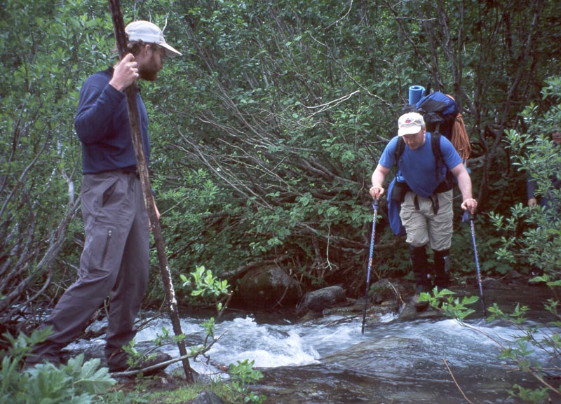
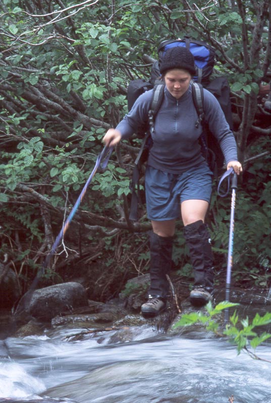
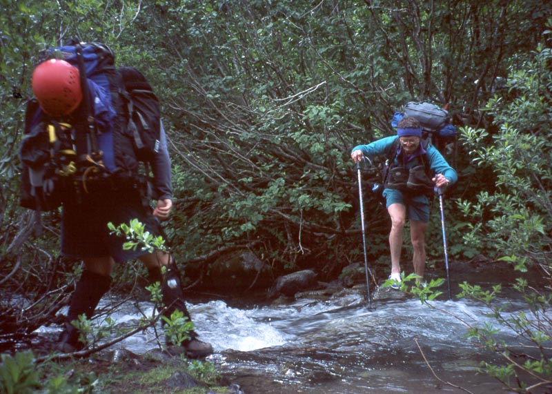
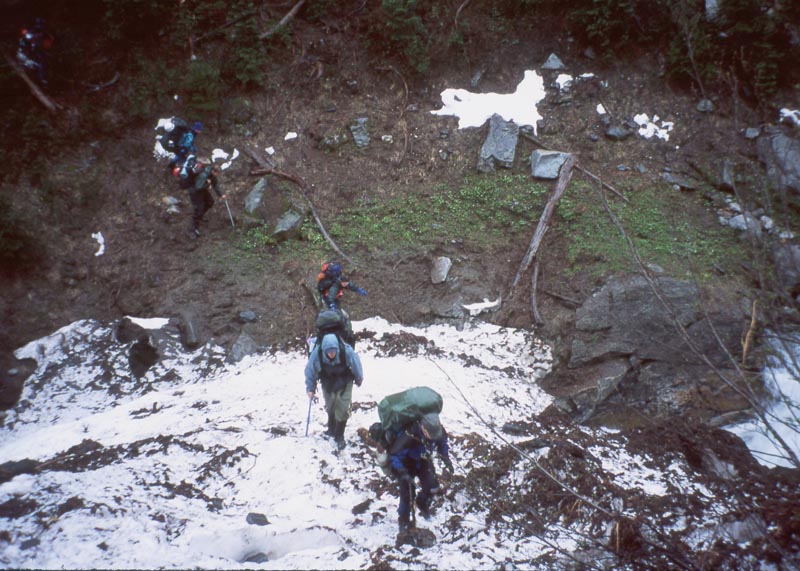
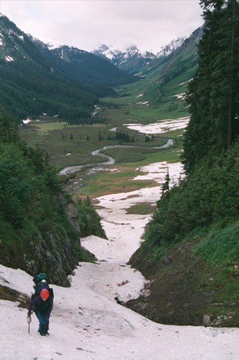
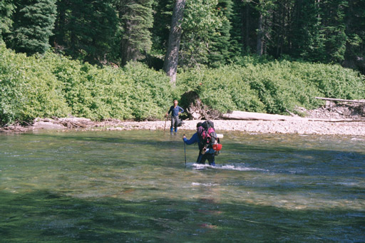
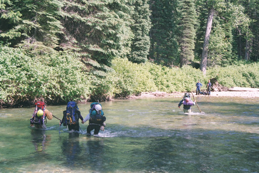
The bugs are incredibly bad, but only down in the White river. They thin out as we climb up toward Bolder basin. Our next challenge is crossing Boulder Creek. It's only a small creek.but flowing exceptionally fast. We boulder hop across the creek, then discover that sectoin was only half the creek. The other is too wide and we have to wade. The water is only up to my shins, but so intensly cold that my feet are in pain by the time I get out the other side.
|
|
|
|
|
|
|
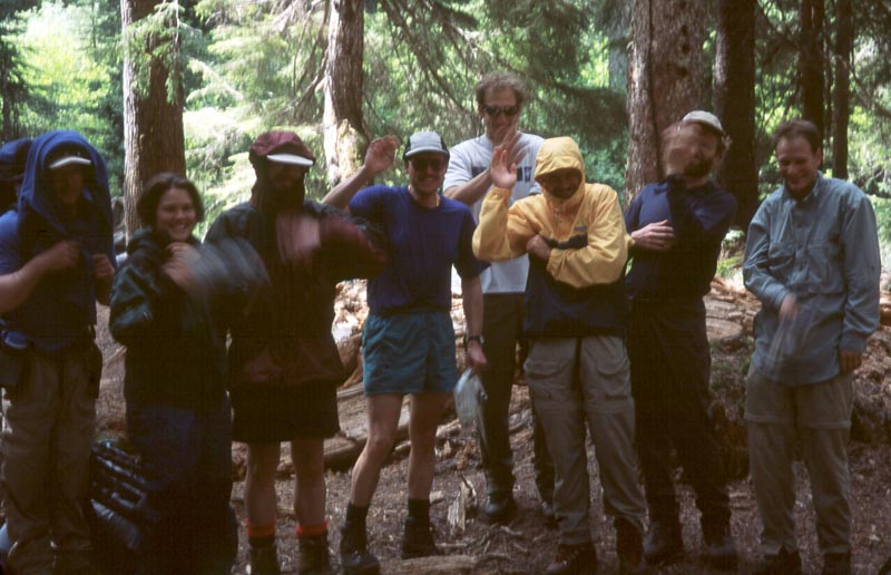
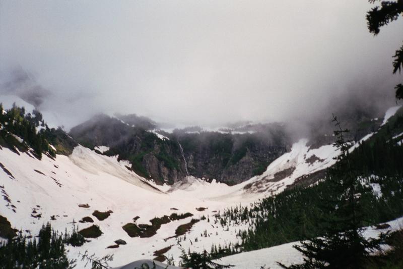
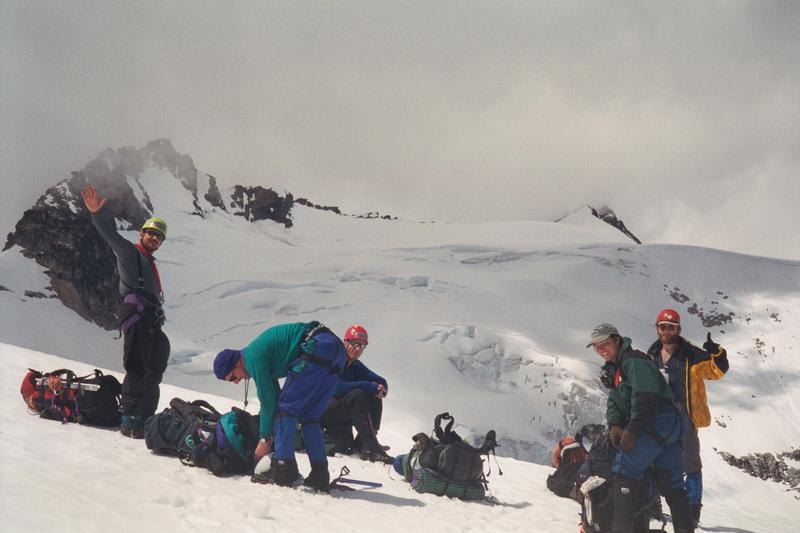
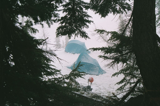
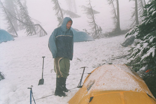
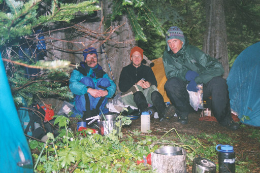
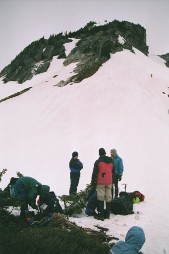
We camped on a small ridge in the middle of Bolder Basin. There was a small sheltered area where we could all kitchen together. The weather was not looking good so we discussed several options, including climbing Clark from here as a day trip.
|
|
|
|
|
|
|
Traverse Clark Mtn.
|
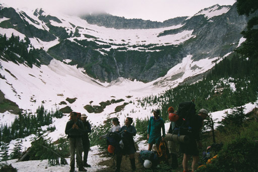
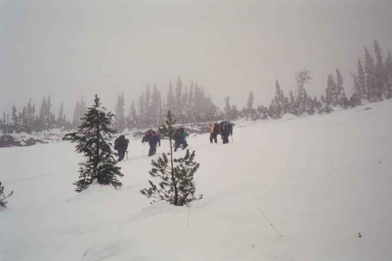
The weather has not improved. During breakfast we talk more about our options. We decide to pack camp, move up to the pass, and hold another council. From there we could proceed with the traverse, or do a day climb then drop down the trail into the Napequa. |
|
|
|
|
|
|
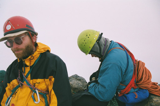
 At the pass we again hold a conference and discuss
the prospects of committing to a traverse of the mountain. I'm using a two phase voting system to facilitate group
decisions. Voting is done by holding up fingers representing our vote. Here zero fingers means veto carry over.
One person can veto the whole carryover if they are that uncomfortable with it. One means a vote against the carry
over. Two means a vote for the carry over. All people decide then expose their vote simultaneously. The first phase
is a non-binding vote held before any discussion so we can see which way people are leaning. Next we have a round
of discussion. People can argue for their preference, and listen to other's. Andrew says some good words about
the positive aspects of committing to a challenging route. Then there is a binding vote.
At the pass we again hold a conference and discuss
the prospects of committing to a traverse of the mountain. I'm using a two phase voting system to facilitate group
decisions. Voting is done by holding up fingers representing our vote. Here zero fingers means veto carry over.
One person can veto the whole carryover if they are that uncomfortable with it. One means a vote against the carry
over. Two means a vote for the carry over. All people decide then expose their vote simultaneously. The first phase
is a non-binding vote held before any discussion so we can see which way people are leaning. Next we have a round
of discussion. People can argue for their preference, and listen to other's. Andrew says some good words about
the positive aspects of committing to a challenging route. Then there is a binding vote.
We decide to carry the packs up to the ridge, then discussion the carry over again. All
this discussion has eaten up a lot of time and I'm beginning to worry about our pace.
|
|
|
|
|
|
|
|
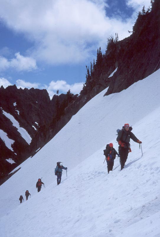
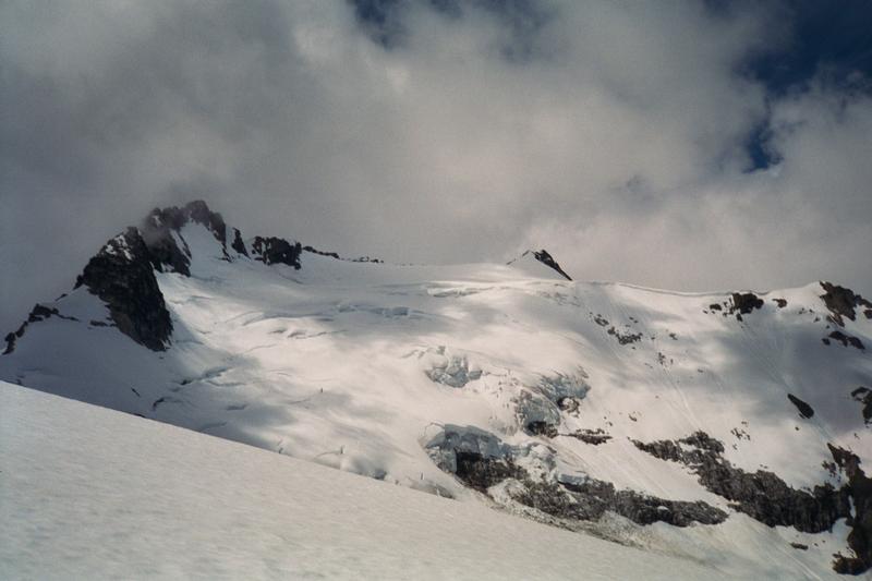
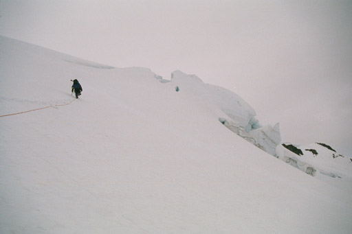
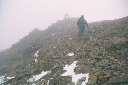
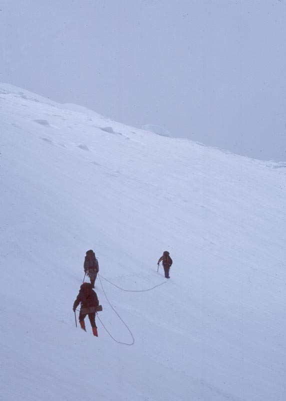
Directly up from the pass we traverse a steep snow slope directly above cliffs. It is perhaps the most dangerous part of the whole route.
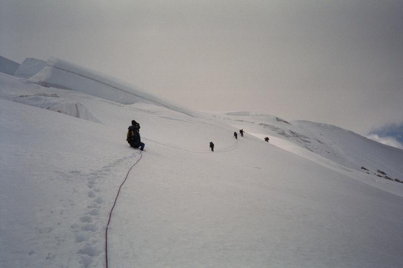
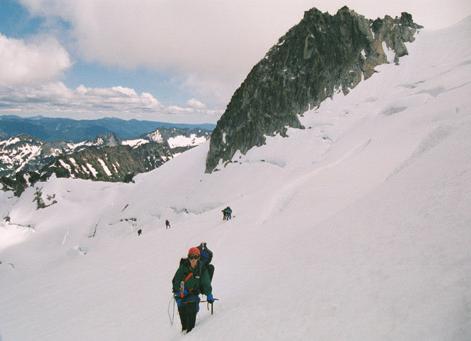
When we get up to the ridge my sense of alpine urgency is strong and I forget about discussing our decision again. We take a short rest, then move on to the base of the glacier and rope up. I put myself in the middle of the rope so that John and Sean will get a chance to experience leading a rope team on a glacier. Sean leads out, diagonaling up the middle of the glacier. The snow is soft and breaking trail is difficult. When I judge that we are half way up we reverse our rope so that John leads. He breaks another several hundred feet of trail then we come to a several crevasses and the route is not clear. John hesitates and I realize that here experience counts and he doesn't have any. So we switch positions, putting me at the front. I lead through the upper crevasses, then continue across a flat bowl, and up it's far side.
|
|
|
|
|
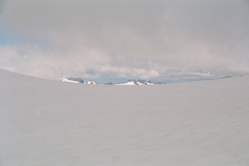
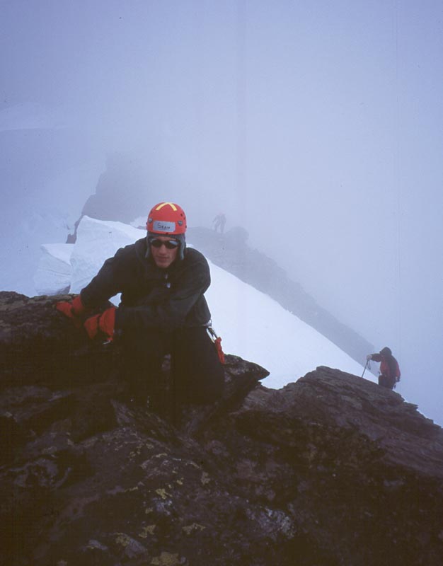
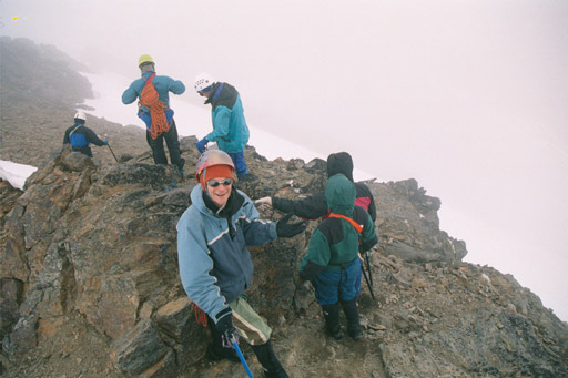
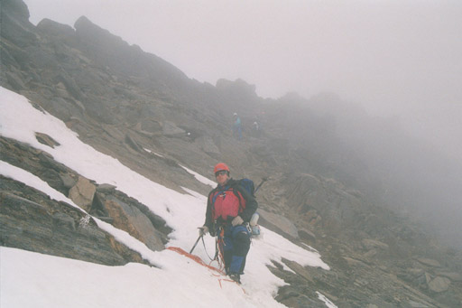
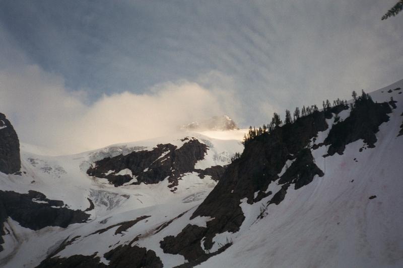
This brings us to the east ridge notch. There is a protected depression just below the notch. We unrope, rest, and allow the other rope teams to catch. up. When we are again assembled we cross through the notch onto the south side of the mountain. We traverse a ways, then head up a snow slope to the ridge crest. The clouds swirl around us. Occasionally they open up, allowing views down the steep north face to the glacier below. I climb from the snow onto the rock. The first couple moves are a little tricky, then the rest easy scrambling.
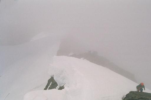
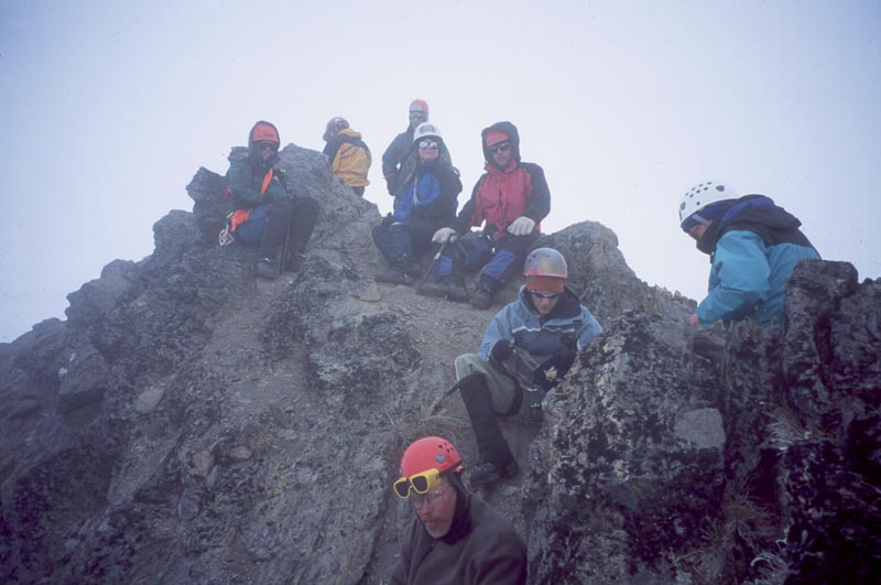
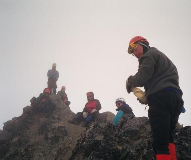
We cross one more snow band, the top of another gully, then arrive at the summit. I look back and take a picture of the folks climbing through the mist. I like summiting in the clouds. It feels like a place remote and of a very different world than the one in which I live every day. |
|
|
|
|
|
|
|
|
|
|
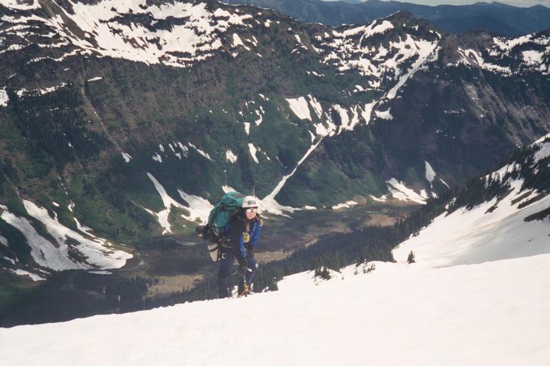
Instead of climbing back down the ridge we descend the rock slope directly south from the summit, then step onto snow and traverse directly back to the east ridge notch.
It is now about 3 pm, and feels late. Andrew latter tells me that at this point he was thinking: "get us the hell out of here." The good thing about a carry over is that we can make camp when ever we need to. We could make camp right here at the notch. It's flat and fairly well protected. But I still hope to complete the Clark range traverse and make it to Butterfly Butte. We rope up again and start out to circle around the north side of the summit. At first we are on flat ground and Andrew and I walk in parallel. Soon the slope stepens and Andrew takes the lead. Then it becomes very steep, running off to cliffs below. We drop down a ways, then turn and traverse to the west. It is an intimidating piece of snow, and some of the students are moving slowly and carefully.
|
|
|
|
|
|
|
|
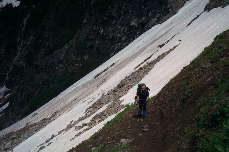
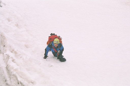
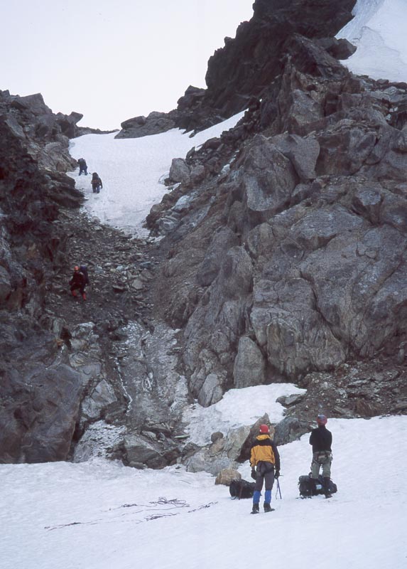
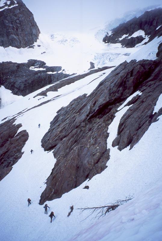
We find that the north side of the notch is a standard Cascade Mountain Loose Gully with Hard Snow. Andrew and some students start down. While waiting for them to clear out Sean and I investigate other options . Further along there is a steep snow slope. On inspection I find that the very beginning is only 60 deg and that the snow provides very secure steps and ax placements. Half the group ends up taking the loose gully and the other half the steep snow.
|
|
|
|
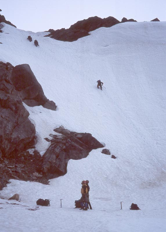
I start off and my rope team is quickly ahead of the other two. Soon I see that in the
worst case we can descend from the glacier on the right. I then go to investigate to the left, which will take
us directly to Butterfly butte. 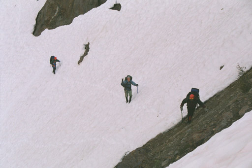 We are in luck: there is still enough snow to provide a route
most of the way. However, the snow is inconsistent and presents the most difficult going of the day. The final
20 ft are on steep, hard pack dirt, requiring use of ice ax.
We are in luck: there is still enough snow to provide a route
most of the way. However, the snow is inconsistent and presents the most difficult going of the day. The final
20 ft are on steep, hard pack dirt, requiring use of ice ax.
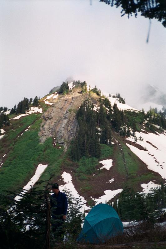
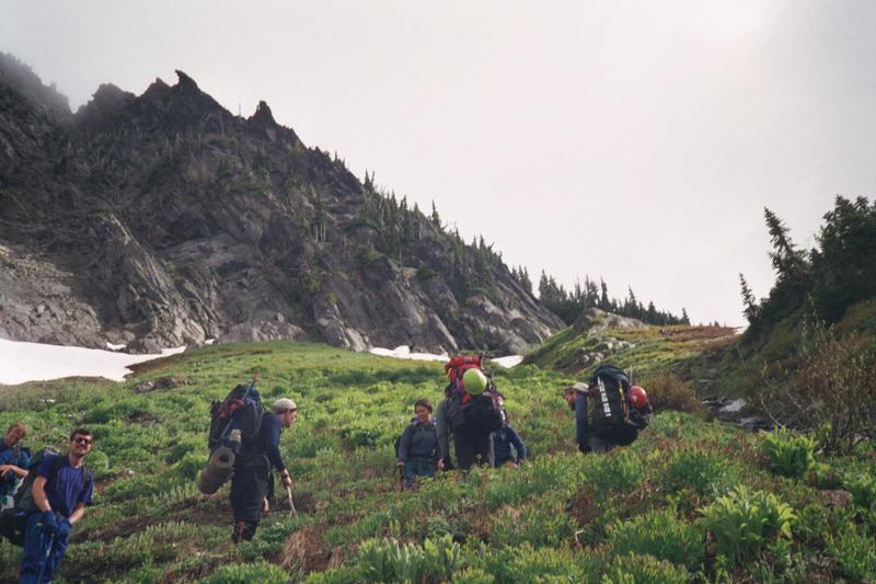
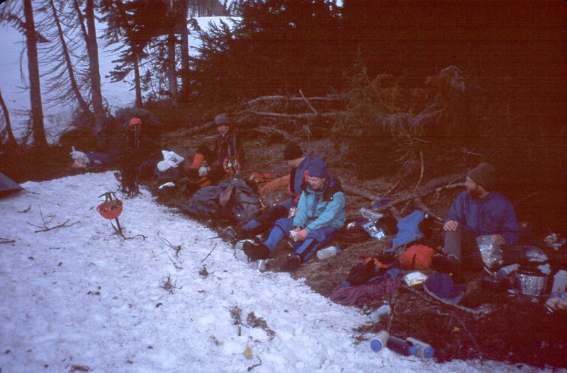
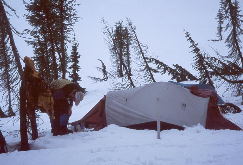
Finally we are all in the basin south of Butterfly Butte. Andrew goes ahead and chooses
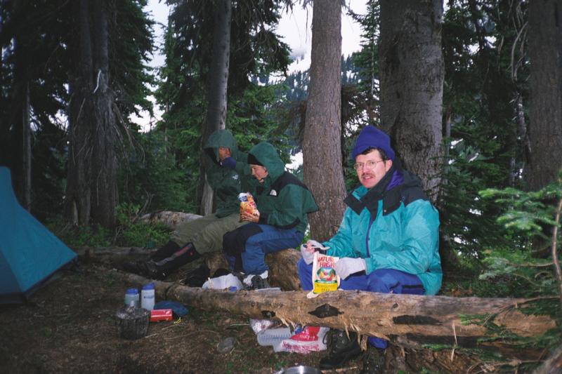
a campsite near a cluster of trees. We set up tents, then cook much needed dinners. Though it has been a hard day,
everyone is in good spirits. The rain does not start till most meals are eaten...
Crossing the Napequa
|
|
|
|
|
|
|
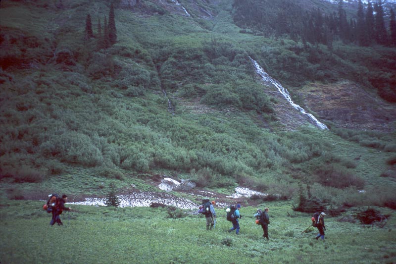
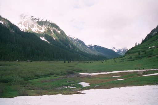
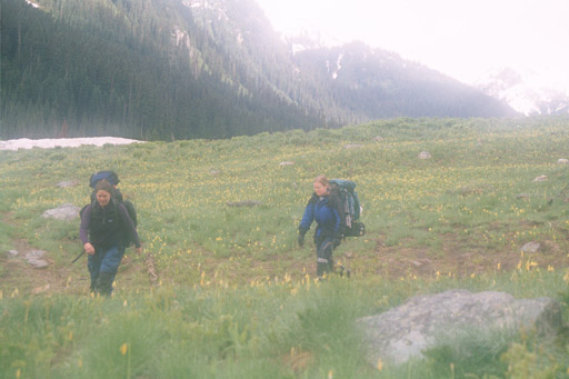
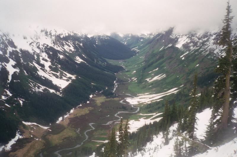
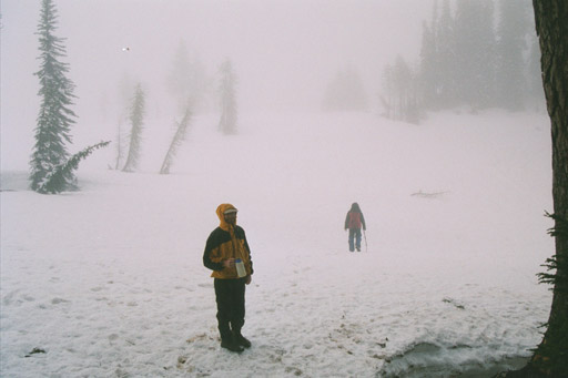
By afternoon there is clearing. We pack up and begin to move. Marie leads us up and over butterfly butte then down the north side toward the Napequa valley. Soon we are out of the snow and making good progress through easy (but wet) brush.
Crossing the Napequa is one of the obstacles that has been weighing on our minds. We reach the river down stream from Lewis Creek and find it to be a torrent. Here it is flowing fast between steep banks. We decide to look further up river and pick our way through the forest. Just below Lewis Creek we find a crossing that would be manageable. Before committing I want to look further. We continue up river. Above Lewis Creek the river is smaller and flows through some reasonable shallows. I think: "This is good, cross somewhere along here, definitely below that snow bridge. ... Snow bridge!"
It didn't register when I first saw it, but there is a huge snow bridge spanning the river just upstream. We bushwhack our way onto it and cross. The far side is an avalanche path which leads directly to the Napequa trail. This crossing could not have gone easier. Lewis creek is also easily crossed on a snow bridge.
We take a break on the far side of Lewis creek. It cold, we are damp, and it's raining again.
|
|
|
|
|
|
We hike for at least another hour, then look for camping. We settle on a spot where we can put all the tents in a circle, under some trees. Well, almost all the tents. Our tent ends up on an uncomfortable hump so we have to move back and are away from the group.
|
|
|
|
Crossing Little Giant Pass and back to the cars.
In the morning we continue our hike down the Napequa. When we come to the slopes below Little Giant Pass we regroup and scan the route. The trail, none too good to begin with, is covered by snow and will probably be difficult to follow. As an alternative, there is a diagonal gully filled with snow providing a direct ramp half way up the face. Above that it looks like we can climb snow slopes to the pass.
|
|
|
|
|
|
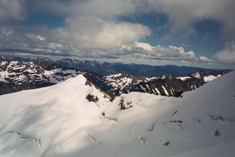
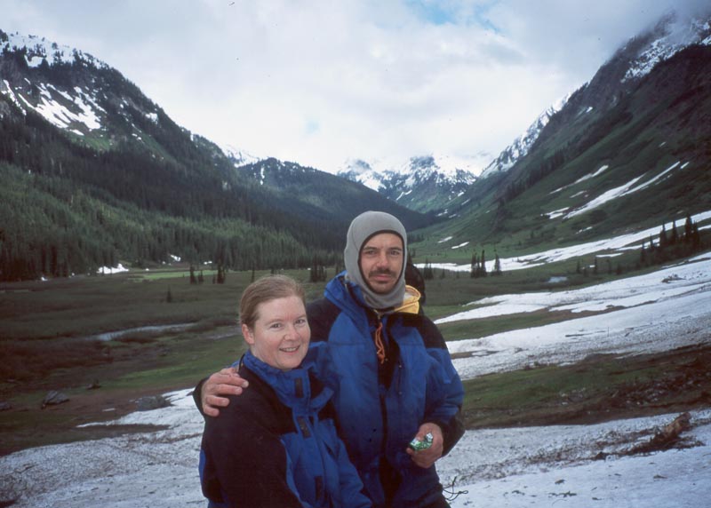
Looking back into the Napequa. |
|
|
The first thing I notice is the large cornice on the other side of the pass. I hike the ridge to get a view of the cornice, hoping to find a weakness that we can descend. It is steep, but not overhanging. However, the snow is hard so we decide to rappel. The other problem is that the whole basin is filled with snow down to below the tree line. This will make picking up the trail difficult. Fortunately, there is a fresh up track which we may be able to follow back down to the trail. Only one thing does not make sense: the up track comes from the far left of the basin and the trail is supposed to be in the center.
We send each of the students over the cornice, then I follow and pull the rope. I traverse over to where everyone has clustered around the up track. I ask Andrew what made the up track. He looks at it for a while and calls back that he doesn't think it was human. It's a fresh bear track. Exciting to think of a bear crossing here just before we arrived. Except that now we have to find the trail ourselves.
|
|
There is only one more obstacle left for us: the Chiwawa River. Before the trip we took a look at the river and decided that we could probably cross. But that has not prevented us from worrying about it the whole trip. Boulder was a cold, difficult crossing and that was only shin deep. The Chiwawa River is 80 ft wide and will be up to our hips. If it is anything as cold as Boulder Creek, and if the weather stays as bad, we are all going to come out of the river deeply chilled. I've been thinking about various ways to rig ropes to make the crossing safer. I'm even speculating about setting a high line that we can traverse on, avoiding the river completely. I realize that if I had really been thinking I would have cached an inflatable dinghy at the crossing. With two we could have even cached on on the far side without anyone ever having to get in the water. That's not an option now. Fortunately, the cars, their heaters, and dry clothing will be just on the other side.
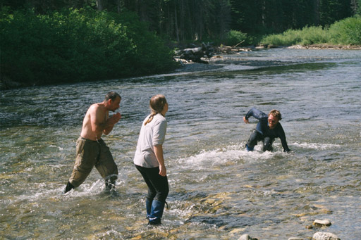
But as we hike down the trail the air temperature gets warmer and and the clouds dissipate. By time time we are at the river we're hot. Our biggest concern is the bugs. We pick a shallow crossing that goes diagonally downstream. Andrew goes first and does fine. We begin to follow in groups of 2 or 3. Even though we picked a shallow line, the water is up to my crotch. But it warm. Well, not warm, but not bitter cold. In fact, once everyone is across I jump in the river to wash off the sweat and dirt from the last 4 days.
|
|
|
|
And that is pretty much the end of the trip. We drive over to pick up our cars at the White River trail head, then have dinner at the 59er Diner.
Before the trip I billed as the "Clark Mountain Extravaganza." It pretty much lived up to that name. We encountered all the alpine difficulties except for technical rock: dense bugs, cold stream crossing, steep snow, glacier crevasses, rock scramble, fog, loose gully, steep dirt, snowfall, cold rain, cornice, dense brush, and a big river. It was a difficult trip by any standard. The student's all did phenomenally well. Not only did they all stand up to the physical challenge of the trip, the stayed in constantly good spirits through out.
[Back] [Home] [Trip Journals] [Climbing] [Kayaking] [Flight] [Photos] [Food]
Page last modified: Feb 01 00:47 2003 by Tom Unger